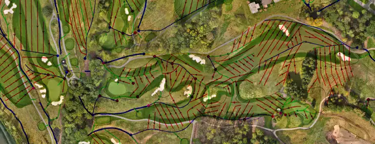
Mapping your golf course and overlaying your Irrigation and Drainage systems with centimetre accuracy
Drone Multispectral Survey
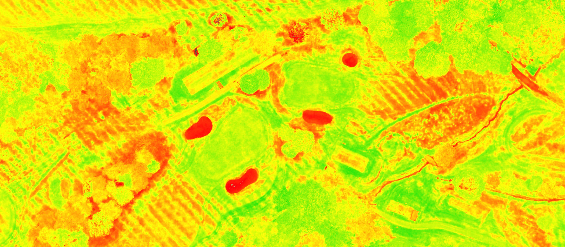
Crop Health: Detects issues like pests and water stress.
Environmental Monitoring: Tracks changes in vegetation and water.
Data-Driven Decisions: Provides actionable insights for better management.
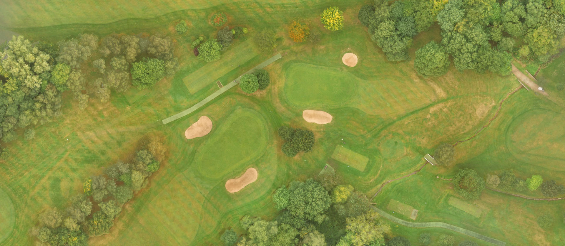
RBG
Multispectral
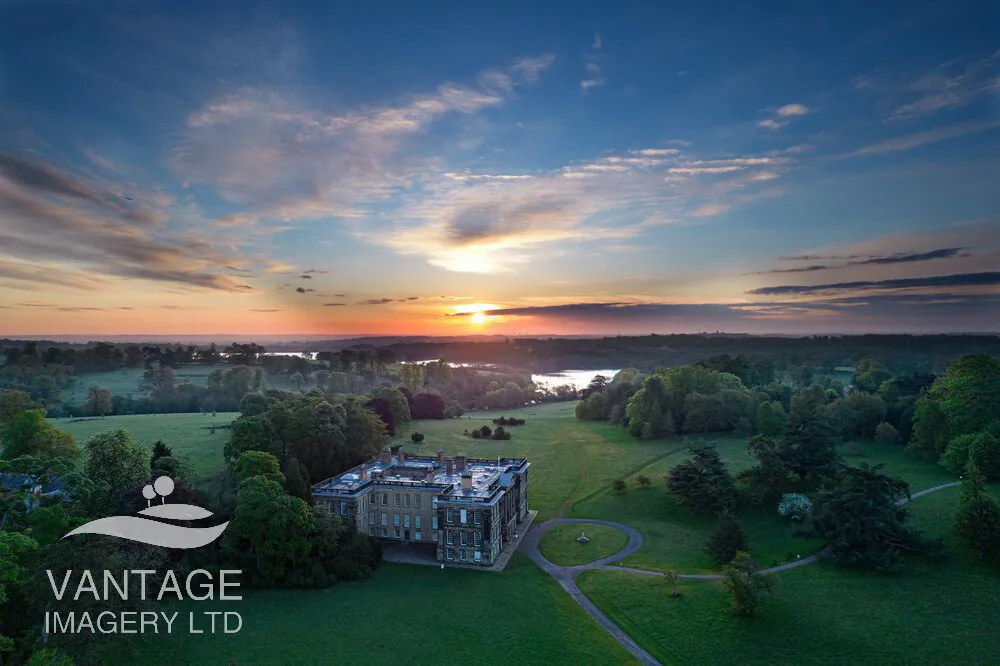
Drone Photography
High-Quality Visuals: Captures stunning, high-resolution images from above.
Versatile Applications: Ideal for real estate, marketing, events, and inspections.
Unique Perspectives: Provides angles and views not possible from the ground.
Testimonial
Client Feedback & Reviews
MG Turf Ltd wish to express our utmost satisfaction with the mapping and drone imagery services provided by Vantage Imagery. Your commitment to delivering high-quality aerial data has significantly enhanced our management and project practices.
Friendly & Professional Service
“I am super impressed with the quality of service I have received from Frazer. The Imagery he shot was amazing and a big help with us moving forward. Highly recommended”.
I work closely with Vantage Imagery in order to create up to date golf course imagery, which I then incorporate into an irrigation control systemsmapping feature to provide the customer with the most realistic view possible. Frazer adds code to the images, re-sizes and formats them in order to make it even easier for me. Great all round service from start to finish"