 Skip to main content
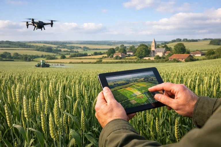
A wheat field can look even from the gate and still be underperforming in three separate ways. One area may be holding water, another may be short on nitrogen, and a third may be showing early disease pressure that is not yet obvious at ground level. That is exactly why crop monitoring for UK farming has moved from a nice extra to a practical management tool. When margins are tight and weather windows are short, better visibility across the whole field matters.
For growers, agronomists and land managers, the challenge is not a lack of data. It is getting the right data, at the right time, in a format that supports action. The value of modern crop monitoring lies in turning aerial imagery, mapping and plant health analysis into decisions that improve timing, reduce waste and sharpen field-by-field planning.
What crop monitoring for UK farming needs to solve
The UK presents a particular set of pressures. Fields can vary sharply in soil type, drainage and exposure within a relatively small area. A wet spring in Yorkshire creates one set of problems, while a dry spell in East Anglia creates another. Add input costs, labour pressure and increasingly close scrutiny on efficiency, and broad-brush management quickly starts to show its limits.
Effective crop monitoring should answer practical questions. Where is the crop developing unevenly? Which areas are under moisture stress? Are drainage issues affecting establishment? Is a patchy canopy caused by compaction, disease, nutrition or something else? If the output does not help narrow those questions, it is just imagery.
That is where aerial survey methods have become more useful than routine visual inspections alone. Walking fields remains essential, but it is selective by nature. You see what you walk. Drone-based surveying and multispectral analysis show the full pattern across the field, making it easier to prioritise where boots-on-the-ground inspection should happen first.
Why aerial crop monitoring is gaining ground
Satellite platforms have improved access to broad crop intelligence, and they have an important place in regular monitoring. But in UK conditions, cloud cover, revisit timing and image resolution can all limit usefulness when decisions are time-sensitive. If a grower needs a clearer view before applying inputs or investigating stress, waiting for the next usable pass is not always ideal.
Drone-based crop monitoring offers a more responsive alternative. It can be deployed when conditions allow, capture high-resolution imagery over specific blocks of land, and produce outputs detailed enough to identify patterns that would be missed in coarser datasets. That matters for variable fields, smaller parcels, high-value crops and any site where precision needs to translate into operational decisions.
For commercial operators, precision is not a marketing word. It is the difference between treating a whole field and targeting the affected area, between reacting late and intervening early, or between assuming a drainage problem and having mapped evidence of where water is actually sitting.
The data that makes crop monitoring useful
Not all crop monitoring outputs deliver the same value. Standard RGB imagery provides a detailed visual record of canopy condition, crop establishment, tramlines, bare patches and visible signs of damage. It is often the clearest place to start because it gives an intuitive overview that farm teams can understand quickly.
Multispectral imagery goes further by capturing reflected light beyond normal visual wavelengths. This helps identify variation in plant vigour and stress before it becomes obvious to the eye. It does not diagnose every issue on its own, but it highlights areas where the crop is behaving differently and where further inspection is likely to pay off.
Then there is the mapping layer. Orthomosaics, elevation models and field surface analysis can reveal how topography, water movement and low spots are influencing crop performance. In many cases, the underlying issue is not simply agronomic. It may be linked to drainage, irrigation, compaction routes or historical field structure. Good crop monitoring should connect plant health with ground conditions, not treat them as separate conversations.
From imagery to action in the field
The strongest argument for crop monitoring is simple – it supports better decisions. But the type of decision matters.
Early in the season, monitoring can help assess emergence and establishment. Uneven development may point to drilling issues, soil variability or waterlogging. At this stage, the main benefit is speed. Problems can be identified before they become expensive to ignore.
As the crop develops, plant health mapping helps direct agronomy attention more efficiently. Rather than spending time checking areas that look acceptable from the field edge, teams can focus on the zones showing measurable stress or irregular growth. That often leads to more informed decisions around nutrition, disease investigation and input timing.
Later in the season, crop monitoring can support harvest planning, yield expectation and review of field performance. If one section repeatedly underdelivers, aerial data can help show whether the problem follows drainage lines, compacted headlands or persistent weak zones. That creates a more useful basis for future remedial work than relying on memory after harvest pressure has passed.
Where the trade-offs sit
Crop monitoring is not a replacement for agronomy expertise, field walking or local knowledge. It is a layer of intelligence that improves all three. The best results come when aerial data is used to focus investigation and confirm patterns, not when it is treated as a standalone verdict.
There are also practical trade-offs between monitoring methods. Satellite monitoring is cost-effective for broad and frequent viewing, but it can lack the resolution or timing needed for precise interventions. Drone surveys provide sharper detail and greater flexibility, but they are usually deployed on a targeted basis rather than every day. For many commercial operations, the right answer is not one or the other. It is a combination based on crop type, farm size, urgency and the decision being made.
Another point worth making is that stress maps do not explain themselves. A low-vigour zone could be linked to disease, nutrient deficiency, poor drainage, rabbit damage or underlying soil variation. High-quality surveying narrows the search area dramatically, but interpretation still matters. This is why service quality is so important. The output needs to be technically accurate and commercially usable, not just visually impressive.
Why precision matters more on variable land
Many UK farms manage fields that are anything but uniform. Changes in elevation, old drainage systems, shaded edges, heavier pockets and worn trafficking routes all influence performance. Averaging those conditions into a single treatment plan often means overspending in some areas and under-correcting in others.
Precision-led crop monitoring gives land managers the confidence to be more selective. It supports variable rate thinking, more targeted drainage investigation and clearer prioritisation of problem zones. That does not always mean complex prescription mapping from day one. Sometimes the immediate value is simpler – identifying the parts of the field that need attention first and proving where recurring losses are coming from.
The same principle is familiar to turf professionals managing high-performance surfaces. Detailed aerial mapping and plant health analysis are valuable because they reveal patterns that are difficult to judge consistently from ground level. Vantage Imagery Limited applies that same precision-led approach to aerial intelligence – data that is designed to support action, not sit in a folder.
Choosing a crop monitoring approach that delivers value
The best crop monitoring system is the one that fits operational reality. A large arable unit may need repeat monitoring across key timings to support broad management decisions. A specialist grower may need high-resolution surveys of specific blocks where crop value justifies a more intensive approach. An estate manager might be more concerned with drainage mapping, persistent poor performers and evidence for infrastructure investment.
What matters is clarity on the objective. If the goal is early stress detection, multispectral survey at the right growth stage may be the priority. If the issue is recurring poor establishment, topographical analysis and drainage visibility may be more useful. If the aim is to improve agronomy efficiency, the key benefit may be directing inspection and input decisions more accurately.
This is also where delivery standards count. Survey-grade accuracy, clean processing and outputs that can be interpreted without technical guesswork make a direct difference to value. Commercial clients do not need vague commentary. They need reliable visual intelligence they can use in planning meetings, agronomy discussions and on-site operations.
The real question is timing
Most crop issues are not expensive because they exist. They are expensive because they are spotted too late, interpreted too loosely or addressed too broadly. Crop monitoring improves the odds of acting at the right moment.
That is especially relevant in UK farming, where the weather rarely waits for ideal scheduling. If a narrow application window appears, or a field starts to slip after heavy rain, decision-makers need more than a hunch. They need a current and accurate view of what is happening across the land.
The farms that get the most from monitoring are usually not chasing technology for its own sake. They are using it to reduce uncertainty, target effort and make each intervention count. When the data is precise, timely and tied to practical decisions, crop monitoring stops being a reporting exercise and starts becoming a management advantage.
The most useful aerial insight is not the image that looks impressive on screen. It is the one that helps you act sooner, spend smarter and understand your fields with far greater confidence.
