 Skip to main content
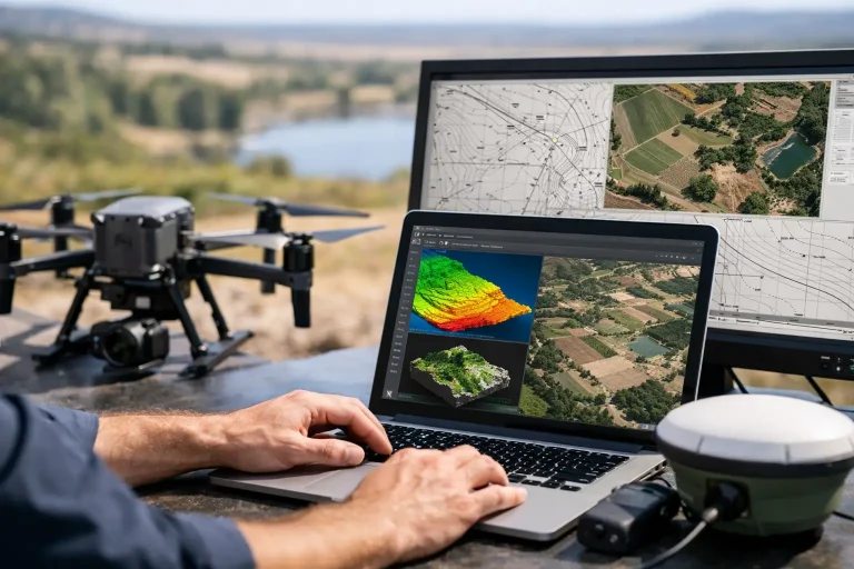
A golf course rarely has one problem at a time. Drainage affects turf quality, irrigation performance affects playability, tree cover changes light levels, and small changes in levels can alter how water moves across a fairway. That is exactly how we use drone mapping and GIS services – not as standalone visuals, but as practical decision-making tools that give course managers, consultants and land professionals a far clearer view of the ground they are managing.
For the right site, drone data can replace guesswork with measurable evidence. But the real value is not simply flying a drone and producing attractive images. It comes from capturing accurate aerial data, processing it properly, and structuring it in a way that supports maintenance planning, project design, asset management and long-term investment decisions.
How we use drone mapping and GIS services in practice
Our approach starts with purpose. Before any survey flight, we define what the client actually needs to understand or improve. On a golf course, that may mean mapping drainage runs, locating irrigation infrastructure, checking surface levels around greens, identifying weak turf areas, or creating a detailed base map for architects and consultants. On a construction or property site, it might be progress tracking, roof inspection planning or topographical context for a wider works programme.
That early step matters because different outcomes require different capture methods. A high-resolution orthomosaic for visual reference is not the same as a topographical model built for measurements. Multispectral analysis has a different role from a standard photogrammetry survey. GIS then becomes the framework that turns those outputs into something useful – layers, attributes and spatial relationships that can be queried, compared and shared across a working team.
In simple terms, drone mapping provides the accurate aerial data. GIS organises that data so it can support real operational decisions.
Starting with survey-grade data, not generic imagery
There is a big difference between aerial content and aerial survey work. Many businesses can capture overhead photographs. That does not mean they are producing data that can support drainage planning, irrigation upgrades or accurate asset location.
Our focus is on precision-led outputs. Using advanced drone survey methods and photogrammetry workflows, we generate centimetre-accurate mapping suitable for professional land management. That means clients are not just receiving a nice view of the course or site. They are receiving measurable surfaces, mapped features and structured spatial information that can be used with confidence.
For golf environments, this is especially valuable because the detail matters. A small level change around a bunker edge or approach can influence runoff behaviour. An unclear utility route can slow maintenance works or create avoidable risk. A poorly understood wet area can keep absorbing budget year after year without the root cause being properly mapped.
When the baseline data is accurate, decisions become faster and more defensible.
Where drone mapping is especially effective
Drone mapping is particularly strong where a site is large, visually complex or difficult to assess properly from ground level alone. Golf courses fit that profile perfectly. They contain varied terrain, multiple infrastructure systems and ongoing maintenance demands across a wide footprint.
From one coordinated survey, we can create high-resolution orthomosaic maps, digital surface models, contour data and detailed visual records. This allows course teams and consultants to stop working from fragmented information. Instead, they can assess the whole layout and then zoom into specific problem areas with much better context.
That said, drone mapping is not always the only answer. Dense canopy, buried services and enclosed internal structures may still require complementary survey methods. The best results often come from combining drone data with existing plans, site knowledge and specialist ground investigation where needed.
Using GIS to make mapping operationally useful
GIS is where mapping becomes management intelligence. Rather than storing survey outputs as isolated files, we use GIS to build a structured picture of the site. Layers can include fairways, greens, bunkers, paths, ponds, drainage lines, irrigation assets, tree groups, building footprints and maintenance zones. Each feature can then hold useful information, not just a shape on a map.
For a golf club, that can mean linking infrastructure locations with maintenance planning. For an irrigation specialist, it can mean viewing pipe routes, valve positions and control areas in a format that supports troubleshooting and future upgrades. For consultants and architects, it creates a reliable base for design review, feasibility work and phased development planning.
The benefit is clarity. Instead of searching through separate drawings, PDF plans, staff memory and old contractor notes, teams can work from one organised spatial reference point.
Irrigation, drainage and utilities
This is one of the most valuable applications. Water management issues are rarely solved by looking at one hole or one wet patch in isolation. Drainage performance, topography, infrastructure condition and usage patterns all interact.
By combining aerial mapping with GIS layers, we can help clients visualise how the site is laid out and where systems relate to one another. Drainage runs can be overlaid against surface models. Irrigation components can be mapped in a clearer operational format. Utility routes can be recorded and referenced with better spatial accuracy than many legacy plans provide.
That improves day-to-day maintenance, but it also supports longer-term capital planning. If a club is reviewing irrigation renewal, redesigning a hole, or investigating recurring ground conditions, having accurate mapped context reduces uncertainty.
Turf health and multispectral insight
Standard aerial imagery shows visible condition. Multispectral survey work can go further by highlighting plant stress patterns that may not be obvious from the ground or through conventional photography.
For turf managers, that can be useful when investigating inconsistent performance, assessing irrigation effectiveness or identifying early signs of stress across larger areas. The key is interpretation. Multispectral outputs should not be treated as a standalone diagnosis. They are most valuable when viewed alongside local knowledge, weather conditions, soil behaviour and maintenance history.
Used properly, this kind of data can help prioritise inspection and intervention. It gives teams a faster way to focus attention where the course is already signalling a problem.
How we use drone mapping and GIS services for planning projects
Survey data is not only for identifying faults. It is equally valuable when a site is changing. Golf course improvements, construction works, building inspections and estate management projects all benefit from a reliable aerial baseline.
For course consultants and architects, drone mapping can provide detailed topographical context before design work begins. For construction managers, it can support site progress records, spatial comparison over time and clearer communication with stakeholders. For property and facilities teams, it can assist with roof inspections and wider asset visibility without the disruption and cost of more invasive access methods.
The commercial advantage is speed with accuracy. Traditional methods still have an important place, but drone surveys can often deliver high-quality coverage much more efficiently across large or awkward sites. That efficiency matters when projects are time-sensitive or when operational disruption needs to be kept low.
Why specialist interpretation matters
Technology on its own does not create value. The difference comes from understanding the environment being surveyed and the decisions the client needs to make afterwards.
Golf sites are a good example. A generic drone operator may produce imagery, but that does not guarantee they understand why a green surround needs precise contour information, why drainage mapping must be tied to real maintenance outcomes, or why irrigation data needs to fit existing operational workflows. The same principle applies in construction and property settings – data is only useful when it answers the right questions.
That is why a consultative process matters. We do not treat every site as identical, because it is not. The survey method, output format and GIS structure should reflect the actual commercial and operational use case.
The trade-off clients should understand
The main trade-off is between speed, detail and objective. If a client only needs a quick visual overview, that can be produced relatively simply. If they need survey-grade topographical mapping, utility overlays and GIS-ready layers for long-term use, the specification becomes more detailed. That affects capture planning, processing time and project scope.
This is not a drawback. It is simply the reality of precision work. Better outputs depend on the right survey design from the start.
For many of our clients, that investment pays for itself through fewer assumptions, better targeted maintenance, clearer contractor communication and stronger evidence for future planning. In a sector where poor information can lead to repeated remedial costs, accurate mapping quickly becomes a practical asset rather than a technical extra.
At Vantage Imagery Limited, we see drone mapping and GIS as part of a better way to manage land and assets – precise enough for professionals, clear enough for everyday use, and structured to support decisions that need to stand up over time. If your site still relies on outdated plans, incomplete records or visual guesswork, the next step is not more paperwork. It is better visibility.
