 Skip to main content
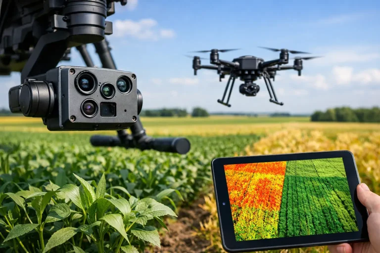
If your agronomy decisions still rely mainly on what can be seen from a buggy path or during a morning walkover, you are almost certainly finding problems later than you should. A proper multispectral camera for agronomy review is not about prettier imagery. It is about identifying stress patterns, moisture-related variability and nutrient response early enough to act before turf performance drops.
For golf courses, sports turf and wider land management, that distinction matters. The right sensor can help reveal weak areas that are not yet obvious at ground level, but the wrong setup can leave you with expensive maps that look technical and answer very little. The useful question is not simply which camera is best. It is which camera produces repeatable, decision-ready data for the agronomic problem you are trying to solve.
What a multispectral camera actually needs to do
A multispectral camera captures reflected light in specific bands beyond standard RGB imagery. In agronomy, that usually means combinations of blue, green, red, red edge and near-infrared. Those bands are then used to generate vegetation indices and spatial comparisons that help assess plant vigour, stress and variability across a site.
That sounds straightforward, but performance depends on much more than band count. Sensor calibration, radiometric consistency, shutter design, geo-referencing and compatibility with your flight and processing workflow all affect whether outputs are genuinely comparable over time. If you are reviewing a camera for agronomic use, the real test is repeatability. Can it show meaningful change between one survey and the next, not just produce one impressive-looking map?
For turf managers and consultants, this is especially important where conditions can change quickly with irrigation cycles, localised dry patch, shade, compaction and drainage variation. A camera that performs well in broad-acre agriculture is not automatically the best fit for fine turf where smaller features and tighter management tolerances matter.
Multispectral camera for agronomy review – the key criteria
The first thing to assess is spectral relevance. Most agronomy-focused cameras now include the bands needed for standard vegetation indices such as NDVI, NDRE and GNDVI. That is useful, but band placement matters as much as band presence. A red edge band with suitable centre wavelength and bandwidth often gives better sensitivity for moderate to dense vegetation than NDVI alone, particularly where turf is already reasonably healthy and you are trying to separate good from very good, or stressed from slightly stressed.
Spatial resolution is the next major factor. On a golf course, subtle variation around greens, approaches and fairway pinch points can be operationally significant. If pixel size is too coarse at the planned flying height, patterns may be blurred into something too general to act on. Higher resolution is helpful, but it must be balanced against flight efficiency, processing time and survey consistency.
Radiometric calibration is not optional if you want data you can trust. Cameras that support calibrated reflectance panels and sunlight sensors are far better suited to serious agronomy work than systems relying on raw image brightness alone. Without calibration, changes in cloud cover, sun angle and atmospheric conditions can distort results enough to confuse actual plant response with simple lighting variation.
You should also look closely at integration. A camera may be technically strong yet awkward in day-to-day use if data export is limited, processing is cumbersome or outputs do not fit into existing mapping and maintenance workflows. The best systems support practical interpretation, not just image capture.
Sensor quality versus headline features
One common mistake in any multispectral camera for agronomy review is giving too much weight to marketing features. More bands, higher megapixels or newer branding do not automatically translate into better agronomic value. What matters is how reliably the system captures the relevant data and how easily that data can be turned into site-specific action.
For example, some compact systems are excellent for rapid condition monitoring where speed and simplicity matter more than laboratory-grade precision. Others are designed for more demanding survey-grade work, with better calibration and alignment between bands. The choice depends on whether you need broad visibility, high-confidence comparison over time, or integration with detailed topographical and infrastructure mapping.
On managed turf, false certainty is a real risk. If a camera produces visually dramatic outputs but struggles with calibration, band alignment or repeatable geolocation, it can lead teams towards the wrong areas or exaggerate issues that do not hold up on the ground. That wastes labour and weakens trust in the technology.
What good data looks like in practice
Useful agronomy imagery does not stop at a colour-coded health map. It should help answer practical questions. Where is stress concentrated? Is the pattern linked to irrigation performance, shade, footfall, compaction or drainage? Is a weak area expanding, stable or recovering? Which zones need immediate inspection and which can wait?
That is why context matters. Multispectral outputs are far more powerful when interpreted alongside elevation models, drainage layouts, irrigation plans, utility routes and local management knowledge. On a golf course, a stressed corridor on fairway turf may have very different causes depending on whether it coincides with poor surface runoff, inconsistent sprinkler coverage or repeated machinery traffic.
This is where specialist delivery makes the difference. A technically capable operator with agronomic understanding will not present indices as magic answers. They will use them as part of a wider evidence base, narrowing down likely causes and directing follow-up action more efficiently.
Review of the main strengths and trade-offs
The strongest argument for multispectral cameras in agronomy is early visibility. They can reveal spatial inconsistency before symptoms are obvious at eye level, helping teams prioritise inspection, adjust inputs and track recovery. That can improve irrigation decision-making, support targeted interventions and reduce blanket treatments.
Another strength is coverage. Walking every hectare with the same consistency is difficult, especially across large or complex sites. A drone-mounted multispectral system can assess whole properties quickly and create a baseline that is much easier to compare over time.
The trade-offs are equally important. Multispectral data does not diagnose everything on its own. It indicates response, not always cause. A stressed area may reflect moisture deficit, disease onset, nutrient issue, rootzone inconsistency or wear pressure. Ground-truthing remains essential.
Cost is another factor. Higher-end sensors, calibration equipment and specialist processing add expense. That cost is justified when data quality supports operational savings or protects asset performance, but it is not sensible to over-specify if your needs are basic and infrequent.
Weather and timing also matter. Poor flight conditions, inconsistent survey timing or irregular methodology can reduce comparability. Agronomy review works best when capture is structured, repeatable and tied to management questions rather than ad hoc curiosity.
Is one camera enough for serious agronomy work?
Usually, no. Or at least, not in isolation.
Multispectral imagery is most valuable when combined with standard RGB orthomosaics, topographical context and on-site inspection. RGB still provides critical visual detail. Elevation data helps explain water movement and drainage behaviour. Asset mapping gives operational context. Together, they turn spectral response into something a course manager, consultant or irrigation specialist can use with confidence.
That is why many commercial clients now look beyond the camera itself and focus on the survey outcome. The sensor matters, but so do flight planning, control points, processing discipline and interpretation. A good camera in the wrong workflow will underperform. A strong end-to-end survey process often delivers more value than chasing the newest hardware release.
Who should invest and who should outsource?
If you need frequent internal monitoring across a large estate, in-house capability can make sense, provided you have the skills and time to maintain standards. But for many golf and land-management operations, outsourcing remains the better commercial decision. You get access to specialist equipment, certified flight operations and a survey methodology designed around accuracy and practical outputs.
That is particularly relevant where multispectral surveys need to sit alongside topographical mapping, irrigation analysis or drainage review. In those cases, the real value is not ownership of a sensor. It is receiving integrated, decision-ready information.
For clients who want that level of precision, businesses such as Vantage Imagery Limited bring the camera into a broader surveying service rather than treating it as a standalone gadget.
Final view on a multispectral camera for agronomy review
A multispectral camera earns its place in agronomy when it helps you act earlier, target resources better and understand variation with more confidence. The best systems are not the ones with the longest feature list. They are the ones that deliver consistent, calibrated and interpretable data within a disciplined survey workflow.
If you are reviewing options, focus less on the headline spec sheet and more on the decisions the data will support. That is where value shows up – not in the map itself, but in better timing, sharper interventions and fewer surprises across the ground you manage.
