 Skip to main content
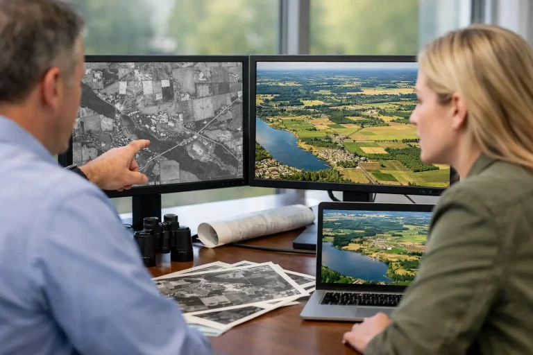
A green has started to hold water every winter. A bunker edge seems to have crept out of shape. A fairway that once drained cleanly now struggles after moderate rain. In many cases, the answer is not hidden underground – it is sitting in the record of what the site looked like years ago. That is one of the clearest benefits of historical imagery: it shows when change started, how it progressed and where management decisions need to focus.
For golf courses, estates, construction sites and managed landscapes, current imagery tells you what is happening now. Historical imagery adds the missing context. It turns a snapshot into a timeline. That difference matters when budgets are tight, maintenance priorities compete and every intervention needs to be justified with evidence rather than instinct.
Why the benefits of historical imagery are practical, not just visual
Historical imagery is often treated as an interesting archive feature. In reality, it is an operational tool. When you compare older aerial records with recent survey data, you can see pattern shifts that are difficult to identify from ground level alone. Tree encroachment, bunker migration, worn traffic lines, drainage decline and changes in vegetation density become much easier to measure.
For decision-makers, this reduces guesswork. A course manager planning drainage work can review whether a wet area is a long-term problem or a newer failure. An architect assessing remodelling options can see how original design lines have softened over time. A facilities team can track roof deterioration or site expansion against previous conditions. The value is not in nostalgia. The value is in evidence.
There is also a commercial benefit. When you can show a timeline of change, internal discussions become more productive. Boards, committees, owners and contractors tend to respond better to visual proof than verbal descriptions. Historical imagery helps turn maintenance concerns into documented issues that can be prioritised, costed and scheduled.
Seeing landscape change with far greater clarity
Managed land changes gradually, which is exactly why problems are often missed. Small shifts in surface condition, edge definition or vegetation spread rarely stand out day to day. Across three, five or ten years, they become obvious.
That long-view perspective is particularly useful on golf courses. Fairway lines narrow as rough matures. Trees alter airflow and light levels around greens. Paths shift through wear patterns. Water features expand or silt up. Historical imagery allows teams to compare past and present conditions with objectivity, making it easier to distinguish natural development from decline that requires intervention.
The same principle applies beyond golf. On construction and development sites, historical records can reveal how boundaries, access routes or spoil areas have evolved. On commercial property, they can support condition assessments by showing the pace of visible deterioration. On larger estates, they help land managers track use patterns and identify where infrastructure or planting plans have altered site performance.
Better drainage and irrigation decisions
Some of the strongest benefits of historical imagery appear when dealing with water movement. Drainage and irrigation problems are rarely isolated. They build over time through compaction, blocked outfalls, grading changes, root growth or system deterioration.
By comparing imagery from different seasons or years, teams can often identify recurring wet zones, shifts in turf vigour and changes in runoff behaviour. That does not replace a drainage survey or irrigation audit, but it provides valuable context before works begin. You are not just reacting to the latest visible symptom. You are assessing a pattern.
For irrigation specialists, this historical view can also support more precise planning. If one section of turf has repeatedly presented stress signatures over time, the issue may relate to coverage, pressure, drainage interaction or soil profile rather than a one-off weather event. Older imagery helps narrow the likely causes.
This is where survey-grade current data and historical visual records work best together. Historical imagery highlights the trend. Accurate aerial mapping and overlays help define the solution.
Stronger planning for renovation and capital works
When a project moves into design or capital planning, historical imagery becomes even more valuable. It gives consultants, contractors and site managers a clearer basis for understanding what has changed and what should be restored, reshaped or protected.
On a golf course, that may mean reviewing how bunkers originally sat within the hole strategy, how tree growth has affected playing lines, or whether green surrounds have lost their intended form. Without that reference point, renovation can become too reactive, responding only to current appearance rather than to the broader design and maintenance history.
For non-golf sites, historical imagery supports phasing decisions, access planning and pre-works reviews. It can show where previous disturbance has taken place, how storage areas have expanded or how surface use has shifted over time. Those insights help reduce surprises during project delivery.
There is a trade-off here. Older imagery is only as useful as its quality, consistency and alignment with present-day survey outputs. If historic records are low resolution or captured at awkward angles, they may be better for broad trends than precise measurement. That is still useful, but it is important to separate visual indication from survey certainty.
A clearer case for tree, habitat and boundary management
Tree and vegetation management often becomes contentious because changes happen slowly and different stakeholders view them differently. One person sees maturity and character. Another sees shade pressure, airflow restriction and rising maintenance burden. Historical imagery helps move that conversation onto firmer ground.
Aerial comparisons can show where tree canopies have expanded into managed turf, where sightlines have closed, where rough margins have advanced or where habitat areas have shifted in practical effect. This supports more balanced decisions. It is not simply a case for cutting or clearing. In many situations, the right outcome is selective intervention informed by measured change.
Boundary management also benefits. Fences, hedgerows, access edges and informal use zones can all drift over time. Historical imagery provides a visual baseline that helps teams confirm whether encroachment, wear or operational spread has occurred and whether corrective action is justified.
Better communication with committees, owners and contractors
Technical teams often know a site has changed, but they still need to explain why action is needed. That can be difficult when the audience is not on the ground every day. Historical imagery gives those conversations structure.
Instead of saying a green complex has become too shaded, you can show the canopy increase. Instead of arguing that a path route is failing, you can demonstrate how wear has widened season by season. Instead of estimating that drainage performance has worsened, you can point to recurring patterns in affected areas.
This matters because budget approval is rarely driven by technical detail alone. It is driven by confidence. Clear visual evidence improves confidence. It also helps external contractors understand the brief more quickly, which can lead to tighter scopes and fewer misunderstandings once work starts.
Combining historical imagery with modern aerial survey data
Historical imagery is most powerful when it is not used in isolation. On its own, it tells you what changed. Combined with modern drone survey outputs, it starts to explain the operational impact of that change.
For example, an older aerial image may show that a bunker edge has gradually shifted and lost definition. A recent centimetre-accurate topographical model can then quantify the current form, levels and surrounding drainage behaviour. Historical records may reveal repeated stress in a fairway section, while current multispectral analysis can show the present health response in far greater detail.
That combination is especially effective for professional land-management teams because it supports both strategy and action. Historical imagery builds the case. Current data informs the intervention.
A specialist provider such as Vantage Imagery Limited can add value here by turning imagery into practical outputs rather than simply supplying pictures. For commercial clients, that distinction matters. The objective is not to collect more visuals. It is to improve decisions.
Where historical imagery has limits
Historical imagery is useful, but it is not magic. Seasonal timing can distort comparisons. A dry summer image and a wet winter image may suggest a stronger contrast than underlying conditions justify. Resolution differences can also affect interpretation, especially if older records are patchy.
There is also the question of context. Visual change does not always explain the cause. A thinning turf area may reflect irrigation coverage, soil profile, traffic, disease history or a combination of factors. That is why the strongest workflow pairs imagery review with site knowledge, ground-truthing and accurate survey data.
Used properly, though, historical imagery narrows uncertainty considerably. It helps teams ask better questions before they commit time and money to the answer.
The real value of the benefits of historical imagery
The real advantage is straightforward. Historical imagery gives professional land managers a better memory of the site than memory alone. It records details that day-to-day familiarity tends to hide. It shows whether a problem is isolated or progressive, whether change is acceptable or costly, and whether planned works are based on evidence.
For golf courses in particular, that can influence everything from drainage investment and bunker renovation to tree management and presentation standards. For other commercial sites, it sharpens maintenance planning, asset oversight and project preparation.
If you are responsible for land, surfaces, infrastructure or presentation, the past is not background information. It is operational intelligence – and the earlier you bring it into the decision-making process, the easier it becomes to act with precision rather than assumption.
