 Skip to main content
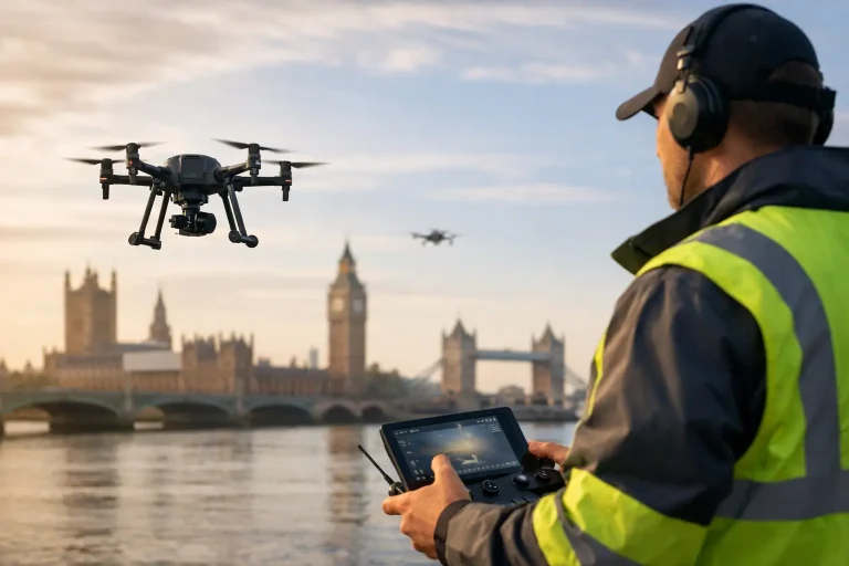
If you commission drone surveys for a golf course, construction site or large estate, the detail in UK drone laws 2026 matters long before the aircraft leaves the ground. A missed permission, the wrong operational category or weak site planning can turn a straightforward survey into delay, cost and unnecessary risk. For commercial clients, regulation is not background admin – it directly affects how quickly reliable aerial data can be captured and delivered.
Why UK drone laws 2026 matter to commercial projects
For recreational flyers, regulation often feels like a set of flying rules. For commercial landowners and site managers, it is more practical than that. The legal framework determines where a drone can operate, how close it can get to people and property, what level of pilot competence is required, and whether a planned mission is viable at all.
That has real implications for operational jobs. A golf course drainage mapping survey may need low-level, methodical coverage over active playing areas. A roof inspection may involve built-up surroundings, parked vehicles and public access. A construction progress survey may require repeat flights over a live site with multiple contractors present. Each of those scenarios depends on the regulatory position, not just on pilot skill or aircraft capability.
The main point for 2026 is not that every rule will be completely rewritten. It is that commercial operators and clients should expect continued focus on competency, risk-based permissions, airspace awareness and accountable data capture. The businesses that plan around compliance early will move faster than those treating regulation as an afterthought.
The likely direction of UK drone laws 2026
No serious operator should guess at legislation, but it is reasonable to expect continuity in the broader structure. UK drone regulation is already built around operational categories, operator responsibilities, registration, competency and safe separation from people, property and sensitive airspace. By 2026, the most likely shift is refinement rather than wholesale change.
That means commercial clients should expect stronger emphasis on documented procedures, flight risk assessments and evidence that an operator is qualified for the type of work being undertaken. In practice, this benefits professional end users. It creates a clearer distinction between survey-grade commercial delivery and general aerial photography.
For buyers of drone services, that distinction matters. If you need centimetre-accurate mapping for irrigation planning, topographical modelling or utility visibility, legal compliance is part of technical quality. A fully compliant operation is more likely to deliver repeatable, insurable and dependable outputs.
Expect risk-based operations to remain central
The broad direction of travel is towards proportionate regulation. Lower-risk flights with suitable aircraft and separation measures are treated differently from higher-risk flights in constrained spaces. That is sensible, and it is unlikely to disappear.
For commercial sites, this means the answer to “can a drone fly here?” will continue to be “it depends”. Open land with controlled access is very different from a busy visitor site. A remote fairway survey is different from an inspection above a clubhouse, car park or nearby road. The legal route may exist in both cases, but the planning, pilot credentials and operational controls may differ significantly.
Operator competence will stay under scrutiny
By 2026, clients should be asking more of a drone provider than whether they are insured and available next week. They should want to know whether the operator understands category limits, airspace checks, site-specific hazards, contingency procedures and the level of permission required for the mission profile.
That is especially true where the output is being used for business-critical decisions. A turf health survey, drainage assessment or earthworks model is only useful if the data was captured lawfully, safely and to a repeatable technical standard.
What commercial clients should ask before booking a flight
The right question is not simply whether an operator is “legal”. It is whether they are legally and technically suitable for the specific task.
Start with the intended outcome. Are you commissioning visual imagery for marketing, or survey data for planning and maintenance? The regulatory burden may overlap, but the operational standard should not. Survey work usually demands tighter planning, more controlled capture methods and greater attention to repeatability.
You should also ask how the operator intends to manage people on site, active work areas and neighbouring land. On golf courses, for example, safe coordination with play, maintenance vehicles and staff movements is essential. On construction sites, lift zones, temporary structures and changing site access can alter the flight plan quickly. Good operators treat those variables as part of the job, not as last-minute obstacles.
A professional provider should be able to explain the operational category, any limitations relevant to the mission, and what permissions or controls are needed. They should also explain what cannot be done. That honesty is usually a sign of competence, not caution for its own sake.
How the rules affect golf courses and large managed estates
Golf courses are well suited to drone mapping, but they are not regulation-free environments. They combine open land, infrastructure, workers, visitors, vehicles, trees, water bodies and, often, nearby residential boundaries or roads. From a legal and operational point of view, that mix requires disciplined planning.
Where drone regulation becomes commercially useful is in creating a framework for reliable site work. If a survey is planned properly, flying can be scheduled around play, sensitive areas can be accounted for, and the final output can feed directly into drainage reviews, irrigation mapping, bunker redesign, vegetation monitoring and broader course development.
That is where specialist operators add value. A provider focused on precision mapping understands that the flight is only one stage. The wider job is to produce data that supports practical decisions while staying fully within the operational rules.
Survey work is not the same as aerial content capture
This distinction is often missed. Promotional video and stills can be valuable, but survey-grade mapping introduces a different level of discipline. Ground control, overlap planning, altitude consistency, data processing standards and geospatial accuracy all matter. Regulation interacts with those technical requirements because the safest legal route may not always be the most efficient capture route.
For example, flying higher may reduce some ground-level risk considerations, but it can also affect image resolution and mapping detail. Flying at a lower height may improve survey quality, but only if the operational environment and permissions support it. Good planning balances legal compliance with output quality rather than sacrificing one for the other.
Common misunderstandings around UK drone laws 2026
One common mistake is assuming that owning a capable aircraft makes complex commercial work straightforward. It does not. Aircraft technology has improved quickly, but regulation still depends on where, how and why the drone is being used.
Another misunderstanding is that private land ownership gives automatic freedom to fly. It does not. Control of land access and control of airspace are not the same thing. A site manager may authorise work on their property, but the operation still has to comply with wider aviation rules and any local constraints.
There is also a tendency to think regulation is mainly about avoiding penalties. In commercial reality, it is more about project certainty. Legal compliance reduces the chance of aborted missions, insurance issues, poor stakeholder communication and data that cannot confidently be relied on.
What a compliant commercial operation should look like
A strong operation begins before the day of flight. There should be a clear understanding of the objective, the site environment, likely hazards, surrounding airspace and the most suitable aircraft and capture method. The operator should have a defined plan for take-off and landing zones, battery management, emergency procedures and public separation where relevant.
On site, communication matters just as much as flying skill. Staff should know when the aircraft is operating, what areas are affected and whether access controls are needed. If conditions change, the operator should be ready to pause or revise the mission. Professionalism often shows up in those moments, not just in the final imagery.
After capture, proper handling of the data matters too. If the survey is being used for measurement, modelling or asset planning, workflow discipline is part of the service. That is one reason businesses such as Vantage Imagery Limited focus on actionable outputs rather than generic drone footage. The commercial value sits in usable information, captured and delivered to a standard clients can trust.
Preparing for 2026 without overreacting
The sensible approach is not to wait for a dramatic legal shift. It is to build better commissioning habits now. If you regularly use drones for mapping, inspections or progress reporting, work with operators who can explain the regulatory basis for the mission and how that affects deliverables, timing and site requirements.
For site managers, it also helps to think ahead about access windows, public interfaces and operational constraints. The best drone projects are rarely improvised. They are scoped around both the technical need and the legal environment, which usually means fewer delays and better data.
As 2026 approaches, the businesses that benefit most from drone technology will be the ones treating compliance as part of performance. When the legal framework, flight planning and output specification are aligned, drone surveys become far more than aerial visuals – they become a dependable management tool.
