 Skip to main content
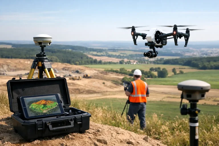
A drone flight that produces a sharp aerial image is easy to buy. Survey grade drone data is something else entirely. If you are making decisions about drainage routes, irrigation upgrades, earthworks, bunker rebuilds or asset records, the difference between attractive imagery and measurable data is the difference that matters.
For golf courses and other managed sites, that distinction has practical consequences. A centimetre-level model can support design, maintenance planning and contractor coordination. A basic aerial map cannot. That is why the phrase gets used so often – and why it is worth being precise about what it actually means.
What survey grade drone data means
Survey grade drone data refers to aerial data captured and processed to a known, dependable level of positional accuracy. In simple terms, points, contours, features and measurements taken from the output should align closely with their true position on the ground.
That sounds straightforward, but the phrase is often used loosely. A drone on its own does not automatically produce survey-grade results. The aircraft is only one part of the workflow. Accuracy depends on the sensor, flight planning, ground control, GNSS correction methods, processing standards and quality checks after the flight.
If one of those elements is weak, the final model may still look convincing while being unsuitable for technical use. This is where many buyers get caught out. A visually impressive orthomosaic or 3D model can still drift, warp or misrepresent elevation if the survey method has not been designed properly.
Why accuracy is not just about the drone
When clients ask whether a drone can produce survey grade drone data, the honest answer is yes – but only when the whole process is built around accuracy.
A high-spec aircraft helps, but it is not the deciding factor on its own. Positional reliability comes from how the mission is controlled. Ground control points, checkpoints, RTK or PPK correction, overlap settings, camera calibration and terrain conditions all influence the result. Even the time of day and the consistency of light can affect the quality of photogrammetric reconstruction.
On a golf course, this matters more than many expect. Fairways, greens surrounds, drainage lines and path edges can look deceptively simple from the air, yet subtle height changes are often the most important part of the survey. If elevation control is poor, the output may be fine for a presentation image but weak for planning remedial works.
The building blocks of reliable outputs
The strongest drone surveys combine precise capture with disciplined processing. That normally begins with a clear specification of what the data needs to do. A course architect reviewing levels around a green complex needs something different from a facilities manager checking roof condition or a contractor tracking cut-and-fill volumes.
Once the purpose is clear, the capture method can be matched to it. Photogrammetry is commonly used for orthomosaics, topographical models and surface mapping. LiDAR may be the better route where vegetation cover, dense structure or difficult terrain limit photogrammetric performance. Neither is automatically better in every situation. It depends on the site, the required output and the level of detail needed.
Control on the ground is another major factor. Ground control points provide known reference positions that anchor the model. Checkpoints then verify whether the final data is actually meeting the expected standard. Without that verification stage, claims about accuracy are far less meaningful.
Processing also deserves more attention than it usually gets. Survey data is not simply stitched together and exported. It needs careful alignment, error checking, surface refinement and validation. Done well, that produces outputs that can be trusted in CAD, GIS and course management workflows. Done badly, it creates polished-looking files that cause problems later.
Where survey grade drone data creates real value
The reason commercial clients invest in this level of data is not novelty. It is utility. Accurate aerial outputs save time, improve decisions and reduce rework.
For golf courses, one of the clearest applications is topographical understanding. Subtle landform drives playability, drainage behaviour and maintenance burden. Survey-grade outputs can reveal fall lines, low spots, surface shape and infrastructure relationships with a level of clarity that is difficult to achieve through traditional site walks alone. That is useful for greenkeeping teams, consultants and architects alike.
Drainage and irrigation planning is another strong example. If pipe routes, valve boxes, sprinkler heads and surface features can be mapped against reliable positional data, the result is more than a picture. It becomes an operational layer that supports fault finding, planning and future upgrades. The same applies to utility overlays and asset records across the wider site.
There is also value during project work. Bunker renovations, tee rebuilds, path installation and reshaping schemes all benefit from an accurate before-and-after baseline. Contractors can quantify progress, managers can monitor change, and stakeholders can review a site with far greater confidence.
Outside the golf sector, the same logic applies on construction sites, estates and commercial properties. Roof inspection, stockpile analysis, boundary visibility and progress tracking all become more useful when the data is spatially dependable rather than merely visual.
The trade-off between speed, cost and certainty
Not every job needs survey grade drone data. That is worth saying plainly.
If the objective is a promotional aerial image, a quick visual condition check or broad marketing content, a lighter-touch flight may be perfectly appropriate. Survey-grade standards add planning, control, processing and verification. That adds cost and time, even though it is still often faster and more efficient than traditional methods.
The right question is not whether survey grade is always better. It is whether the decisions you need to make depend on accurate measurement. If they do, cutting corners early usually creates extra cost later. If they do not, a simpler output may be the sensible option.
For experienced site managers, this distinction matters because budgets are real and not every requirement deserves the same specification. Precision should be applied where it creates operational value, not used as a badge for its own sake.
What to ask before commissioning a survey
A good provider should be able to explain how accuracy will be achieved, not just promise it. Ask what method will be used to control the survey, how the data will be checked, what outputs you will receive and whether those files are suitable for your intended software or workflow.
It is also sensible to ask about experience in your type of environment. Golf courses, for example, are not generic sites. They contain subtle contour, varying surface textures, water features, tree cover and operational constraints around play. A team that understands those conditions is more likely to plan the work properly and produce data that is useful from day one.
Timing matters too. Seasonal growth, low winter light, saturated ground and active works can all affect capture quality. The best surveys are not simply flown when the drone is available. They are scheduled when conditions support the objective.
Survey grade drone data is only valuable if people can use it
There is a final point that often gets overlooked. Accuracy on its own is not enough. The data has to be delivered in a format that supports action.
That may mean topographical mapping for design teams, utility overlays for irrigation planning, surface models for drainage assessment or clear visual layers for management reporting. The strongest providers do not stop at capture. They translate technical outputs into information that the client can actually use.
This is where specialist service makes a difference. A golf club manager does not need a lecture on photogrammetry. They need reliable mapping that helps prioritise investment. A greenkeeping team needs visibility of levels, features and infrastructure in a form that supports the day-to-day reality of maintaining the course. A consultant needs confidence that the base data is sound enough to build recommendations on.
That is the real standard to judge by. Survey grade drone data should not just look precise. It should stand up to scrutiny, integrate into decision-making and give you a clearer route from observation to action. For clients who manage land, infrastructure and playing surfaces where detail matters, that is where the value starts.
