 Skip to main content
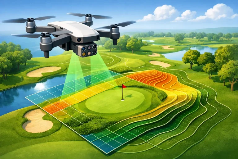
A fairway can look level from a buggy path while hiding subtle falls that affect drainage, irrigation run-off and playing quality. That is why the question, are drones accurate, needs a more useful answer than simply yes or no. Professionally planned drone surveys can produce centimetre-accurate mapping, but only when the aircraft, positioning method, ground control, processing and quality assurance are selected for the job.
For golf courses, construction sites and managed estates, the difference matters. An attractive aerial image may be useful for communication, but it is not automatically reliable enough to set out works, investigate standing water, update an irrigation plan or calculate earthworks. Survey-grade drone data is a measured dataset, not just a photograph taken from above.
Are drones accurate enough for professional surveys?
They can be. The accuracy of a drone survey depends on the required output and the workflow used to create it. For many topographical mapping, asset-recording, drainage-planning and progress-monitoring projects, a well-executed drone survey can achieve horizontal and vertical accuracy at centimetre level.
However, centimetre accuracy should never be treated as a blanket promise. A drone may record a large area quickly, yet its final data can be compromised by weak satellite reception, unsuitable image overlap, poor ground control, surface movement or an incorrect processing setup. The relevant question is not whether the drone itself is accurate. It is whether the final deliverable has been measured, controlled and checked against known positions on the ground.
This distinction is particularly important on golf courses. A course manager may need broad contour information for long-term planning, while an irrigation specialist may need precise positions for valve boxes, heads, pipe routes and levels. Both projects involve aerial data, but the acceptable tolerances, capture method and validation process may differ.
Accuracy, precision and resolution are not the same
These terms are often used interchangeably, although they describe different qualities of a survey.
Accuracy is how close a mapped point is to its true location. If a drainage chamber is shown 20 centimetres from its actual position, the survey is not accurate to the centimetre level, even if the imagery looks sharp.
Precision is repeatability. A system can place the same feature in almost exactly the same wrong position each time. That is precise, but not accurate.
Resolution describes detail within the image, usually expressed as ground sampling distance. A high-resolution orthomosaic can show individual sprinkler heads, bunker edges or roof defects clearly. Yet fine image detail alone does not confirm that every feature is correctly located in national grid coordinates.
Professional survey work needs all three in appropriate measure. Clear imagery makes assets easier to identify. Accurate positioning makes the information dependable in planning and management systems. Repeatable capture enables meaningful comparison between surveys over time.
What controls drone survey accuracy?
The strongest results come from a complete field-to-deliverable workflow. Equipment is only one part of that process.
Positioning technology
Standard consumer GPS can identify a drone’s approximate location, but it is not normally sufficient for survey-grade outputs. Positioning systems such as RTK, or real-time kinematic, improve location data by applying correction information while the drone flies. PPK, or post-processed kinematic, applies comparable corrections after the flight.
Both approaches can support highly accurate mapping, provided satellite observations are sound and the correction data is correctly used. RTK can provide immediate positional confidence in the field. PPK can be valuable where a reliable base-station record is available and data is processed carefully afterwards. Neither removes the need for professional checks.
Ground control and independent checkpoints
Ground control points are clearly marked locations whose coordinates have been surveyed accurately. They anchor the aerial model to the real world and help reduce positional drift across a site. On an undulating golf course, control should be distributed across the survey area rather than concentrated around the clubhouse or one fairway.
Independent checkpoints are equally valuable. These are surveyed points that are not used to build the model. Instead, they test it. Comparing mapped coordinates with checkpoint coordinates provides a transparent measure of final accuracy and reveals whether the model performs consistently across the site.
For projects requiring defensible results, a reported checkpoint assessment is more meaningful than a claim that the drone has RTK. It shows the accuracy achieved in the completed dataset, under the actual conditions of that survey.
Flight planning and image capture
A reliable map begins with a flight plan designed around the terrain, the required accuracy and the features being recorded. Appropriate forward and side overlap allow the processing software to identify common points between images and reconstruct the ground surface. Flying too high may reduce detail. Flying too low may increase the number of images, field time and processing demand without delivering a practical benefit.
Terrain also affects planning. Changes in elevation, tree-lined holes, steep bunker faces and raised greens can introduce shadows and obstruct parts of the ground. A consistent flying height above ground, suitable camera settings and a plan for difficult areas all improve the quality of the source data.
Wind is another consideration. Modern survey drones can operate safely in moderate conditions within their specified limits, but excessive movement may reduce image sharpness. Low sun can reveal contours usefully in some visual work, while creating long shadows that obscure assets in mapping. The best capture window depends on the objective, not simply the first available clear day.
Surface cover and visibility
Photogrammetry maps what the camera can see. It cannot reliably map a drainage pipe beneath turf, a chamber hidden under dense vegetation or bare ground concealed by long grass. It may identify clues, such as persistent wet areas, crop stress or surface depressions, but those observations should be investigated alongside existing plans, ground inspection and, where needed, other survey methods.
Dense woodland and thick scrub are particularly challenging for image-based terrain models. If the project requires ground levels below vegetation, lidar or conventional survey methods may be more suitable. A competent provider will explain this limitation before capture, rather than presenting an attractive surface model as a complete representation of the terrain.
How accurate drone outputs support golf course decisions
When the right survey method is applied, drone mapping gives course teams a practical view of assets and conditions across the whole property. An orthomosaic can provide an up-to-date base plan for measuring areas, recording features and communicating proposed works. A digital surface model and contours can reveal flow paths, low points and grading relationships that are difficult to understand from isolated ground observations.
For irrigation and drainage projects, aerial data can be combined with utility records, as-built information and site observations to create a clearer operational map. The value is not merely knowing where a feature appears on an image. It is being able to use consistent, correctly referenced information when planning repairs, discussing upgrades with contractors or integrating assets into management workflows.
Repeat surveys add another layer of value. Construction progress can be measured against earlier stages, stockpile volumes can be calculated, and vegetation patterns can be reviewed season by season. Consistency in control, capture and reporting is essential here. Comparing two datasets with different coordinate systems or unknown accuracy can create misleading apparent changes.
Choosing the right level of accuracy
Not every project needs the same specification. For promotional aerial photography, visual quality and safe operation are the main priorities. For broad course presentation plans, a clear orthomosaic with sensible positional confidence may be sufficient. For drainage redesign, irrigation coordination, design work or quantity calculations, the survey should have a defined coordinate reference system, control strategy and accuracy report.
Before commissioning work, establish what decisions the data will support. Ask whether the output needs to align with existing survey drawings, utility overlays, CAD files or national mapping. Clarify whether levels are required, whether volume calculations will be used commercially, and whether the data must be suitable for design or simply for visual context.
A specialist provider should then recommend a proportionate approach. Over-specifying every project wastes budget, but under-specifying a dataset can create costly rework when a contractor cannot rely on the information. At Vantage Imagery Limited, this means matching precision-led aerial data to the operational task, rather than treating every flight as the same service.
What to ask before relying on drone data
A useful survey brief should cover more than the drone model. Ask what coordinate system and height datum will be used, whether RTK or PPK positioning is included, and how ground control will be established. Confirm how accuracy will be checked independently and whether the final report will state the achieved horizontal and vertical accuracy.
It is also sensible to ask what is excluded. Can the survey represent terrain beneath trees? Are buried utilities being inferred from visible evidence or confirmed from records? Will the final model show the ground surface, the tops of vegetation and structures, or both? Clear answers prevent a visually impressive deliverable being used beyond its reliable purpose.
The most useful aerial survey is the one that lets a course team act with confidence: locating assets correctly, seeing terrain clearly and commissioning works from evidence rather than assumption.
