 Skip to main content
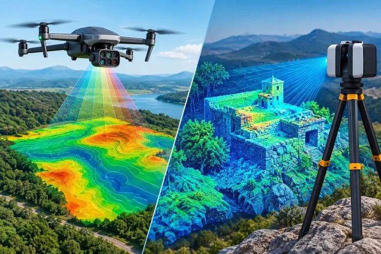
A new drainage route, bunker renovation or irrigation upgrade can succeed or fail on one early decision: whether the survey has captured the ground as it really is. The choice between a drone survey versus laser scanning is not simply a question of which technology is newer. It is about selecting the right dataset for the decisions that follow.
For golf courses, estates and construction sites, both methods can produce highly valuable spatial information. Both can support accurate design, planning and asset management. Yet they see the site differently, perform differently around vegetation and structures, and carry different implications for programme, cost and deliverables.
Drone survey versus laser scanning: the core difference
A drone survey usually refers to aerial photogrammetry. A certified drone captures a large number of overlapping images, which are processed to create a georeferenced orthomosaic, point cloud, digital surface model and contour plan. With suitable survey control, RTK positioning and quality assurance, photogrammetry can provide centimetre-accurate mapping across extensive areas.
Laser scanning uses LiDAR technology to measure distance with pulses of laser light. A terrestrial laser scanner is positioned on the ground and records millions of points around it. Mobile or drone-mounted LiDAR systems can also collect point clouds while moving through or above a site. The result is a dense three-dimensional record of surfaces and objects rather than an image-led model.
The practical distinction is straightforward. Photogrammetry is exceptionally effective at documenting visible surfaces from above, while laser scanning is often stronger where complex geometry, vertical detail or partial penetration through vegetation is required. Neither is automatically the better survey. The right method depends on what needs to be measured, what blocks the view and how the data will be used.
Where drone photogrammetry delivers the greatest value
For an open golf course, drone mapping is often the most efficient starting point. Fairways, greens, tees, bunkers, paths, lakes, rough, buildings and large areas of drainage disturbance can be captured in a single planned flight. The output gives managers and consultants a clear, current visual record alongside survey-grade spatial data.
An orthomosaic is particularly useful because it combines the familiarity of an aerial photograph with measurable detail. A greenkeeping team can identify a damaged path edge, a sprinkler location, a catch basin or a bunker boundary in context. An architect can assess relationships between holes and landform. A contractor can use the same mapped base to plan access, quantities and sequencing.
Photogrammetry also supports contour mapping and terrain modelling where the ground is visible. This is valuable for shaping work, surface-water analysis, construction progress and topographical surveys of open areas. Repeating the survey at defined stages creates a consistent visual record, making change far easier to identify than with isolated ground photographs.
For golf operations, the colour information is a major advantage. Standard RGB imagery helps distinguish maintained turf, bare ground, sand, vegetation and hard surfaces. When paired with multispectral capture, it can also highlight variation in plant health that warrants inspection. That does not replace agronomic judgement, but it gives the course team a far more informed basis for targeting inspections, irrigation checks and maintenance activity.
When laser scanning is the stronger choice
Laser scanning comes into its own when a project demands dense three-dimensional detail of structures or difficult terrain. A terrestrial scanner can capture building façades, retaining walls, bridges, culverts, clubhouse areas, complex roof forms and internal spaces with a level of geometric definition that aerial imagery alone may not provide.
It is also valuable where vegetation prevents a clear view of the ground. Photogrammetry records the top of grass, scrub, bushes and tree canopy because that is what the camera can see. LiDAR can return some laser pulses from lower levels through gaps in vegetation, improving the prospect of modelling the terrain beneath. Results still depend on vegetation density, scan angle and survey design, but the advantage can be significant in wooded margins, overgrown watercourses and heavily vegetated development land.
For irrigation and drainage investigations, laser scanning may be appropriate where chambers, channels, headwalls or structures need to be captured in detail. It can provide an accurate point cloud for engineering design, especially where the project includes vertical faces, confined spaces or geometry that must be measured from multiple viewpoints.
That said, laser scanning does not produce the same natural photographic map as a drone photogrammetry survey. A point cloud is extremely information-rich, but it usually requires specialist processing and interpretation. If the client needs an accessible, full-course visual base map for daily operational use, imagery often remains essential.
Accuracy is not the same as useful accuracy
Both approaches are often described as accurate, but accuracy must be considered against the intended output. A centimetre-accurate aerial model may be more than sufficient for course-wide mapping, preliminary drainage planning, asset inventories and earthworks monitoring. A detailed laser scan may be the right answer for a bridge survey, yet unnecessary for mapping 80 hectares of open playing surfaces.
The survey control behind the data matters as much as the sensor. Ground control points, check points, GNSS observations, flight planning, scanner registration and independent quality checks all influence confidence in the final model. A sharp-looking aerial image is not automatically survey-grade, and a dense point cloud is not automatically correctly georeferenced.
Clients should also distinguish between relative accuracy and absolute accuracy. Relative accuracy concerns how well features align with each other within a model. Absolute accuracy concerns how closely the model aligns with real-world coordinates. For design, construction setting-out, asset integration and comparison with existing drawings, absolute positional confidence is often critical.
Programme, site access and cost considerations
Drone photogrammetry is usually quicker and more cost-effective for large, accessible outdoor sites. A planned flight can capture an entire course or construction area in a short operational window, subject to airspace, weather and site conditions. Processing then turns that capture into mapping products tailored to the project.
Terrestrial laser scanning can require multiple set-ups to avoid occlusions. Each position sees only what is visible from that location, so walls, vegetation and equipment can create shadows in the data. This is not a weakness of the technology, but it does mean that scanning complex sites requires careful planning and can take longer on the ground.
Weather affects both methods, although in different ways. Drone operations require safe wind conditions, suitable visibility and dry enough surfaces for the required imagery. Laser scanners can operate in circumstances that may ground a drone, but rain, reflective surfaces and site safety still need consideration. A sensible survey programme builds in contingency rather than treating weather as an afterthought.
Access is another deciding factor. A drone can document unsafe slopes, roofs, water margins and extensive sites without placing a surveyor in those locations. A laser scanner may still need physical access around a structure or within an area of interest. For roof inspections, aerial imagery may offer the clearest commercial value; for a detailed heritage façade or complicated roof geometry, laser scanning may justify the additional fieldwork.
The best answer is often a combined survey
Many projects benefit from using both technologies rather than forcing one to do every job. A drone survey can establish the broad, georeferenced site model and provide the visual context. Laser scanning can then focus on areas requiring higher-density three-dimensional capture, such as a culvert, retaining structure, pump house, clubhouse elevation or complex construction interface.
This combined approach is particularly effective for golf-course redevelopment. The aerial survey provides a course-wide base for architects, irrigation specialists and project teams. Targeted laser scanning fills gaps where vegetation, structures or intricate geometry demand another level of detail. The deliverables can then be organised around practical use: orthomosaic mapping for operations, contours and terrain models for design, point clouds for specialists, and clearly labelled overlays for assets such as irrigation and drainage.
The key is to define those deliverables before data capture begins. Asking for a survey without agreeing the required coordinate system, accuracy, feature detail and final file formats can create costly rework. The survey should be designed around the next decision, whether that is selecting a drainage route, calculating cut and fill, documenting construction progress or locating infrastructure for maintenance.
Choosing the right method for your site
Choose drone photogrammetry when you need a wide-area, visually clear and measurable record of predominantly open ground. It is a strong fit for topographical mapping, course-wide asset visibility, aerial progress tracking, promotional imagery and repeated surveys that reveal change over time.
Choose laser scanning when your priority is intricate three-dimensional geometry, vertical structures, interior spaces or terrain obscured by vegetation. It is often the more appropriate tool for structural surveys, detailed engineering interfaces and locations where a camera cannot adequately see the required surface.
Choose a combined approach when the site contains both open land and complex features. This avoids paying for high-density scanning across areas where aerial mapping is more efficient, while ensuring critical structures are not simplified or missed.
For any significant project, the most useful question is not, “Which survey is best?” It is, “What decision must this data support?” A precision-led survey partner can translate that answer into the right capture method, control strategy and outputs – giving your team information they can use with confidence long after the flight or scan is complete.
