 Skip to main content
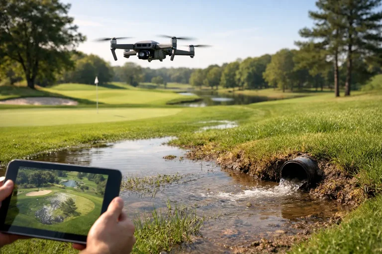
A wet approach that never quite dries, a bunker face that repeatedly slumps, or a fairway that closes after ordinary rainfall can turn into expensive, recurring maintenance problems. Can drones find drainage issues? Yes – but the most useful answer is more precise: drone surveys can identify the surface evidence, terrain patterns and vegetation stress that point to a drainage problem, then provide the measured data needed to investigate and prioritise a remedy.
For golf course managers and greenkeeping teams, this is far more valuable than an attractive aerial photograph. A properly planned survey creates a clear picture of where water is likely to travel, collect or remain trapped. It supports better decisions on drainage investment, irrigation management, construction works and day-to-day course presentation.
What drones can reveal about drainage issues
A drone cannot see through soil and confirm the exact condition of every buried pipe. It can, however, reveal the consequences of poor drainage with exceptional clarity. High-resolution aerial imagery, centimetre-accurate topographical mapping and vegetation analysis can expose patterns that are difficult to recognise from ground level.
The most obvious signs are persistent wet patches, standing water, darker turf, bare areas around inlets and irregular wear on high-traffic routes. On a golf course, these may appear as a soft landing area in front of a green, a damp line across a fairway, pooling at the foot of a bank or a bunker that holds water after rain.
A drone survey also shows the wider context. An isolated wet patch may be caused by a local blockage. Equally, it may sit at the bottom of a subtle catchment, receive run-off from a nearby path, or reflect a poorly graded area created during previous works. Seeing the complete landform prevents teams from treating the symptom while missing the source.
Why topographical data is central to the answer
Drainage follows gravity. That makes an accurate terrain model one of the strongest tools for diagnosing surface-water risk. Using photogrammetry and suitable ground control, a drone survey can produce a detailed digital elevation model and contour plan for the course or a focused problem area.
This data can identify shallow hollows, cross-falls, low points, blocked overland flow routes and areas where water is likely to converge. On land that looks flat to the eye, even a small difference in level can determine whether water reaches a swale, enters a drain or sits across a playing surface.
For a golf course architect, consultant or contractor, this creates a sound basis for planning regrading or new drainage runs. For the course team, it provides measured evidence to explain why a location remains troublesome and to compare potential interventions before ground is broken.
The accuracy required depends on the decision. A broad review of fairway wetness may need a different survey specification from setting out levels for a green reconstruction. The objective should be agreed before the flight, rather than assuming every aerial survey will deliver survey-grade levels by default.
Orthomosaics make recurring faults easier to spot
An orthomosaic is a geometrically corrected aerial image that can be measured accurately. It gives the team a current, top-down record of the site, with enough detail to review drainage grips, outfalls, ditches, gullies, paths and visible pipe features in one consistent image.
When captured over time, orthomosaics become especially useful. Comparing imagery after rainfall, through winter and during a dry spell can distinguish a temporary surface issue from a persistent underlying fault. A wet area that remains visible long after surrounding ground has recovered deserves closer attention.
Historic imagery can also help reveal changes caused by tree growth, silt build-up, construction activity or altered playing routes. Drainage rarely fails without a reason. The visual record helps establish when the pattern began and what may have changed around it.
Multispectral imagery can show hidden turf stress
Healthy turf and stressed turf reflect light differently. Multispectral drone surveys capture wavelengths beyond standard visible imagery, allowing vegetation indices to show variation across a green, tee, fairway or sports surface.
This does not mean every colour change is a drainage defect. Stress can be caused by compaction, disease, shade, nutrient imbalance, irrigation coverage or worn turf. Yet when multispectral results are assessed alongside elevation data, irrigation layouts and site observations, they can identify zones where prolonged moisture is affecting root health and surface performance.
This is particularly valuable where waterlogging has not yet developed into obvious standing water. Early identification gives greenkeeping teams the opportunity to inspect, aerate, adjust irrigation or plan remedial work before playability and turf quality deteriorate.
Where drone surveys add the greatest value
Drone data is most effective when it answers a defined operational question. A course-wide survey may reveal strategic drainage constraints, while a more detailed survey of a few holes can support a specific improvement project.
Common applications include reviewing recurring fairway flooding, assessing water movement around greens and bunkers, locating surface routes towards ponds or ditches, mapping drainage assets before construction, and documenting conditions before and after remedial works. The same data can also support irrigation planning, as overwatering and poor drainage can produce similar surface symptoms.
For clubs considering major capital works, mapped evidence provides a stronger starting point for discussions with drainage contractors, architects and consultants. Rather than relying solely on anecdotal descriptions such as “the seventh is always wet”, the project team can work from measured levels, mapped flow paths and clearly marked problem areas.
The limits of drone drainage detection
Precision matters, but so does being clear about what the technology cannot establish alone. Dense canopy, long grass, heavy shadow and standing water can reduce the quality of photogrammetry outputs. A drone-generated terrain model may represent the top of vegetation rather than the soil surface in heavily vegetated areas.
More significantly, aerial data cannot verify a collapsed pipe, determine its depth or prove an underground connection without further investigation. Existing drainage plans may be incomplete, and visible surface lines do not always match the installed system below ground.
The strongest approach combines drone mapping with targeted ground inspection. That may include probing, trial pits, CCTV drain surveys, dye tracing, flow testing or specialist utility detection. Drone data helps direct these investigations to the places where they are most likely to produce answers, reducing unnecessary disruption across the course.
A practical workflow for investigating wet areas
The process begins with local knowledge. The course manager or head greenkeeper identifies where problems occur, how long they persist, which weather conditions trigger them and whether previous repairs have been attempted. This context shapes the survey plan.
A suitable drone flight is then completed to capture high-resolution imagery and, where required, accurate ground-control data. For drainage assessment, surveying shortly after rainfall can be highly informative, although safe flying conditions and ground access still need to be considered. A second survey during drier conditions can provide a useful comparison.
The resulting imagery is processed into practical deliverables, typically including an orthomosaic, contour plan, digital terrain model and annotated drainage observations. Where plant health is relevant, multispectral outputs may be added. Existing drainage drawings, irrigation plans and utility information can then be overlaid to create a more complete operational map.
The final stage is interpretation. Data should be reviewed with the people who know the site, not treated as an automatic diagnosis. A specialist aerial mapping partner can identify measurable patterns and produce accurate outputs; the on-site team, consultant or drainage contractor brings the history and physical verification needed to specify the right solution.
Turning aerial evidence into better drainage decisions
The commercial benefit is not simply faster surveying. It is the ability to target budgets with greater confidence. Drainage works can be disruptive and costly, particularly around greens, bunkers, established turf and busy playing areas. Knowing where water is entering a problem zone and how it moves across the site helps avoid spending money on isolated repairs that do not resolve the wider issue.
Accurate mapping also improves communication. Clear aerial plans allow committees, contractors and consultants to discuss the same evidence, reducing ambiguity around scope. They can support phased works, show completed improvements and create a reliable baseline for future maintenance planning.
For golf courses with recurring water-management challenges, Vantage Imagery combines specialist aerial mapping with practical, survey-led outputs that can be used by the people responsible for the course. The goal is not more imagery for its own sake. It is clearer evidence for better land-management decisions.
When water repeatedly affects play, turf quality or maintenance time, start by mapping the pattern rather than guessing at the cause. The right aerial data will not replace ground investigation, but it can ensure every inspection, drain run and capital decision begins from a far more accurate view of the course.
