
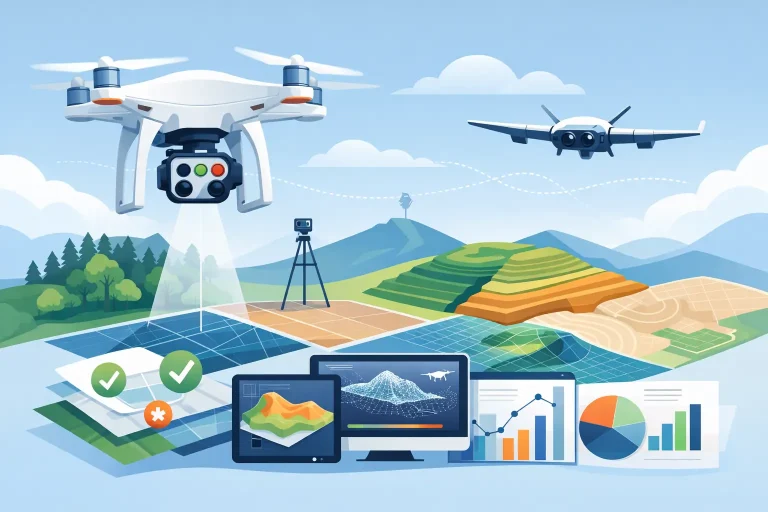
A drone can produce a striking aerial image in minutes. That does not mean it can produce survey data you can safely use to plan drainage, set out construction works or locate irrigation infrastructure. Drone accuracy is determined by far more than the aircraft itself: positioning, ground control, flight design, processing and validation all influence the final result.
For golf course managers, consultants and land professionals, this distinction matters. A map that is a few metres out may be perfectly suitable for a presentation board. The same error can cause costly problems when assessing levels around a green, measuring earthworks or adding assets to an irrigation management system. The question is not whether a drone is accurate. It is whether the output is accurate enough for the decision being made.
What does drone accuracy actually mean?
Drone accuracy is often used as a catch-all phrase, but it covers several separate measures. The most relevant for aerial surveying are horizontal accuracy, which concerns position across the ground, and vertical accuracy, which concerns height or elevation. A third consideration is relative accuracy: how consistently the survey represents features in relation to one another.
A model may look internally consistent, with fairways, bunkers and paths appearing in the right places relative to each other, yet be incorrectly positioned against national grid coordinates. This can happen when imagery is processed without appropriate survey control. It is a serious limitation where data needs to align with design drawings, utility records, previous surveys or operational mapping platforms.
There is also a practical difference between accuracy and precision. Precision describes repeatability. If a system records the same point in nearly the same place every time, it is precise. Accuracy describes how close that recorded point is to its true, surveyed position. A project requires both.
Drone accuracy depends on the survey workflow
The aircraft is only one part of a measurement system. High-quality photogrammetry uses hundreds or thousands of overlapping images to calculate the position of the camera and reconstruct the land surface. The process is highly capable, but it cannot correct weak inputs or poor survey design.
Positioning: standard GPS, RTK and PPK
Most drones record an approximate GPS location for each photograph. This is useful for navigation and initial image alignment, but ordinary satellite positioning is not survey-grade. Depending on conditions, errors can be measured in metres rather than centimetres.
RTK, or Real-Time Kinematic positioning, improves this significantly by applying corrections from a base station or correction network while the drone is flying. PPK, or Post-Processed Kinematic positioning, applies similar corrections after the flight. Both methods can provide highly accurate image positions when correctly configured and supported by reliable observation data.
However, RTK or PPK is not a guarantee of centimetre-level final mapping on its own. Satellite reception can be affected by tree cover, surrounding structures and poor visibility of the sky. A lost correction signal, an incorrectly established base station or unsuitable processing settings can introduce error that is not obvious in a polished orthomosaic.
Ground control points provide independent confidence
Ground control points, often called GCPs, are clearly marked positions measured on the ground using survey-grade GNSS equipment. They give the photogrammetry model known reference points and help ensure it is correctly tied to the required coordinate system.
For demanding projects, control should be spread across the full site, including the perimeter and changes in elevation, rather than clustered around an easy-access area. A large golf course with varied terrain needs a different control strategy from a compact construction compound or a straightforward roof inspection.
Check points are equally valuable. These are surveyed points withheld from processing and used solely to test the completed model. They provide an independent measure of error, rather than allowing a dataset to appear accurate because it has been assessed against the same points used to create it. Where mapping will inform investment, engineering or asset records, check-point reporting should be part of the deliverable discussion.
Flight planning affects the quality of the result
Drone surveys need sufficient image overlap, appropriate flight height and a ground sampling distance suited to the required detail. Flying too high may reduce the detail needed to define kerbs, valve boxes, drainage channels or subtle changes in ground form. Flying unnecessarily low increases collection and processing time without always improving usable accuracy.
Terrain also changes the plan. Sloping fairways, wooded boundaries, raised tees and deep bunkers create varied viewing angles and potential shadow. Crosshatch flight patterns, oblique imagery and terrain-following routes may be appropriate where the site or required output demands them.
Weather is another operational consideration. Bright, even light can support clean imagery, while low sun, moving cloud shadows, rain and strong wind may reduce consistency or make safe operation impractical. A professional survey should be planned around site conditions, not simply flown on the first available day.
Why vertical accuracy deserves closer attention
Horizontal errors are easier to spot because features appear displaced on a plan. Vertical errors can be more subtle, yet they are often more consequential. Drainage investigations, cut-and-fill calculations, contour plans and surface-water assessments all rely on dependable elevation information.
Photogrammetry measures the visible surface. On closely mown turf, this can provide an excellent representation of ground levels. Under dense tree canopy, long grass or vegetation, it records the top of what the camera can see, not necessarily the bare earth beneath. That limitation is not a failure of drone surveying; it is a reason to choose the right method for the task.
Where terrain below vegetation is critical, supplementary ground survey or LiDAR may be more appropriate. For many golf-course applications, a combined approach is the sensible answer: photogrammetry for broad, detailed coverage and targeted field measurements where the surface is obscured.
The output matters as much as the accuracy claim
A centimetre-accurate survey is only useful if the outputs are fit for the people using them. Golf professionals may need a clear, current orthomosaic to communicate works and identify assets. A course architect may require contours, spot levels and CAD-ready data. An irrigation specialist may need pipes, heads, valves and control zones presented in a format that supports maintenance planning.
The same aerial capture can generate an orthomosaic, digital surface model, terrain model, point cloud, contours, volumetric calculations and annotated asset plans. Each output has different strengths and tolerances. Asking for ‘a drone survey’ without agreeing the intended use can lead to unnecessary cost, or worse, data that looks impressive but cannot support the next stage of work.
It is also worth agreeing the coordinate reference system from the outset. Data supplied in the wrong system can create alignment issues when combined with existing drawings, utility overlays or GIS records. This is a simple detail to address before a flight and an expensive one to discover afterwards.
Choosing the right level of accuracy for the job
Not every project requires the same specification. A promotional aerial shoot needs visual quality and careful composition, not survey control. A roof inspection needs clear, safely captured imagery and reliable identification of defects, while a measured roof plan may require a more rigorous workflow.
For golf courses, broad condition mapping may tolerate lower positional certainty than drainage design, irrigation installation or redevelopment planning. Construction progress monitoring may prioritise regular, repeatable capture, whereas stockpile volumes and earthworks verification require stronger vertical control and clear accuracy reporting.
The most effective brief starts with the decision the data must support. From there, the survey provider can define an appropriate capture method, control layout, processing workflow and deliverable format. This avoids paying for specification that adds no value, while protecting against false confidence from data that is not sufficiently reliable.
How to assess a drone survey provider
A credible provider should explain accuracy in practical terms rather than make blanket claims. Ask how positions are established, whether ground control and independent check points will be used, and how final accuracy will be reported. The answer should reflect the site, its terrain, obstructions and intended outputs.
Experience in the relevant environment matters too. Golf courses are not generic open fields. They combine complex ground shaping, managed turf, mature trees, water features, underground systems and active operations. A survey plan needs to respect play, staff access, safety and the specific asset information that will be useful after the flight.
At Vantage Imagery Limited, the focus is on turning precise aerial capture into mapping that supports real operational decisions. That means selecting the level of control and validation the project requires, then delivering data that can be used by managers, greenkeepers, consultants and contractors with confidence.
Before commissioning a survey, define the decision first, then set the accuracy requirement around it. That one conversation is often what turns aerial imagery into dependable site intelligence.