
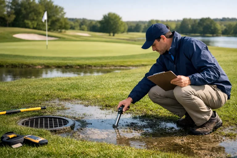
A wet patch beside a green is rarely just a wet patch. It may be the visible result of a blocked outfall, a failed lateral, compacted rootzone, damaged carrier drain or surface water being directed into the wrong place. Knowing how to audit golf drainage means separating these causes before committing budget to remedial work that treats the symptom rather than the system.
For golf clubs, drainage is not simply an agronomy issue. It affects winter play, labour allocation, machinery access, turf quality, member satisfaction and the timing of capital projects. A well-run audit turns anecdotal reports of “that hole always being wet” into a clear, prioritised programme of investigation and improvement.
Start the golf drainage audit with a defined purpose
An audit should answer a specific operational question. It may be to identify recurring winter closures, prepare a drainage renewal scheme, verify installed assets before a bunker or irrigation project, or establish a reliable baseline for long-term course management.
Set the audit boundary first. A whole-course review is valuable when records are poor or the club is planning major investment. However, a targeted survey of greens approaches, fairway low points, tees, bunkers and known wet areas may be the better commercial decision where the issue is localised. The right scope depends on the risk, the available budget and whether water is moving across several holes.
Gather existing information before going on site. Old drainage plans, as-built drawings, irrigation layouts, historic aerial photographs, maintenance logs and staff knowledge all have value. They should not be accepted as definitive. Older drawings commonly omit later alterations, and pipe routes can differ from their original design. They do, however, provide useful starting points for field verification.
How to audit golf drainage on the ground
The most useful inspections take place during, or shortly after, wet weather. Dry-season assessments still reveal topographic issues and ground damage, but they may conceal the behaviour of the drainage network under load. Record the date, recent rainfall, ground conditions and whether irrigation has been running, as each changes the interpretation of what you see.
Walk affected areas with the course manager or head greenkeeper and record observations consistently. Look for standing water, saturated turf, algae, silt deposits at grilles, soft ground around pipe runs, scouring, damaged ditch edges and water backing up at outfalls. Note where tyres rut, where footpaths shed water onto turf and where bunker drainage appears to discharge.
Pay particular attention to transitions. The edge of a green surround, the low side of a tee, the bottom of a fairway hollow and the interface between a renovated area and older construction are frequent problem locations. Water often gathers where different soil profiles, levels or drainage designs meet.
It is useful to classify each issue by severity rather than relying on a simple wet or dry judgement. A practical classification could distinguish between areas that are inconvenient, areas that materially reduce playing quality, and areas that cause regular closures or create safety and machinery risks. This makes later investment decisions far easier to defend.
Test the drainage system, not just the surface
Surface symptoms indicate where water is presenting, but not necessarily where the failure sits. If access points, catchpits, inspection chambers and outfalls are available, inspect them for water level, silt, root ingress, collapse and restricted flow. Outfalls deserve particular scrutiny: a network cannot discharge effectively if its final outlet is submerged, blocked, damaged or poorly maintained.
Where there is evidence of a buried asset failure, targeted drain jetting, CCTV inspection or carefully selected trial pits can establish pipe condition and depth. These interventions carry cost and should be directed by survey evidence, rather than used indiscriminately across the course.
Not every wet area is a pipe problem. On heavily trafficked ground, compaction can prevent infiltration even when the drains are functioning. On putting surfaces, an unsuitable rootzone, organic matter accumulation or a perched water table may be more relevant than the condition of collector drains. The audit should therefore combine drainage investigation with informed turf and soil assessment.
Use topographical mapping to explain water movement
Drainage works best when the landform supports it. Small changes in level can determine whether water reaches an inlet, bypasses a swale or pools against a bunker face. This is why accurate topographical mapping is central to a modern drainage audit.
A drone survey can produce a detailed orthomosaic and centimetre-accurate terrain model when undertaken with appropriate survey control and processing. These outputs reveal subtle falls across greens surrounds, fairways, pathways and maintenance areas that are difficult to understand from ground observation alone. Contours, slope analysis and flow-path modelling help identify where water is naturally trying to travel.
The benefit is not merely a clearer aerial image. Survey-grade data allows the project team to compare reported wet areas with the actual landform, locate low points, assess catchment direction and establish whether proposed drains have a viable fall to an outfall. It also creates a measured base plan for designers, consultants and contractors.
There are limitations. Dense vegetation, standing water and tightly overhanging tree cover can reduce the clarity of surface modelling, while conventional aerial imagery cannot confirm the condition or exact route of buried drains. The strongest audits combine drone-derived mapping with field observations and targeted underground investigation.
Build one usable drainage record
A drainage audit should result in a live asset record, not a folder of disconnected photographs and notes. Map known and verified pipe routes, chambers, ditches, headwalls, culverts, catchpits, outfalls and problem areas in one coordinated drawing. Each feature should have an identifier, condition rating, photographs where helpful, and notes on access and maintenance requirements.
Where drainage plans overlap with irrigation, utility routes or proposed construction, align the datasets to the same coordinate system. This reduces the risk of accidental damage during trenching and gives the club a far more reliable basis for planning works. It also means a future contractor can understand the site without rebuilding the evidence from scratch.
For older courses, confidence levels are useful. Mark assets as confirmed, probable or unverified rather than presenting every historic line as fact. That small distinction protects the club from false certainty and identifies where further validation is needed.
Prioritise failures by operational impact
The largest wet area is not always the first project to fund. A small failure at a high-traffic green entrance may have a greater effect on presentation, playability and labour than a larger low-lying area in light rough. Rank findings according to their impact on the course and the likelihood that the problem will worsen.
Consider four factors together:
- frequency and duration of waterlogging;
- effect on play, safety, turf health and machinery access;
- risk to nearby assets such as bunkers, paths, greens or buildings;
- feasibility of repair, including fall, access, discharge permissions and construction disruption.
This approach usually produces three workstreams. Immediate maintenance might include clearing outfalls, repairing damaged grilles and removing silt. Targeted repairs may involve jetting, patching or replacing failed pipe sections. Capital works could include new collector drainage, regrading, reconstructed bunkers, attenuation features or revised surface-water routes.
Cost should be assessed against the expected outcome, not against the length of pipe installed. Installing more drainage where surface levels are wrong or discharge is constrained can be poor value. Conversely, a relatively modest regrade or outfall improvement can make an existing system perform as intended.
Turn findings into an investable drainage plan
The final audit deliverable should allow decision-makers to move from evidence to action. Include an annotated topographical plan, a drainage asset map, a schedule of defects, photographs, confidence ratings and a prioritised recommendation plan. For significant projects, provide enough spatial information for a drainage designer or golf course architect to develop detailed proposals without repeating the initial survey.
Set review dates as well. Drainage changes over time as pipes silt up, tree roots develop, surfaces are renovated and weather patterns shift. Updating the record after major works, and revisiting known pressure points each year, keeps the data useful rather than historic.
A precision aerial survey is particularly valuable when clubs need to make drainage investment decisions with confidence. Vantage Imagery Limited combines high-accuracy mapping with practical golf-course insight, helping project teams see the ground, the assets and the water movement in one clear picture.
The best time to begin is before the next prolonged wet spell turns a manageable weakness into lost playing days. Capture the evidence, verify the assets and give every drainage decision a measured basis.