 Skip to main content
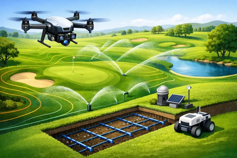
A dry patch on a green is rarely just a dry patch. It may reflect a weak head, an incorrectly recorded lateral, a pressure issue, changing soil texture or a controller programme based on assumptions rather than current conditions. Future irrigation systems are being designed to replace those assumptions with accurate, connected evidence – helping golf courses apply water where it is needed, when it is needed, and with a clear understanding of why.
For course managers and greenkeeping teams, this is not simply a move towards more technology. It is a practical response to rising water costs, ageing infrastructure, changing weather patterns and the expectation of consistent playing surfaces. The most effective systems will combine intelligent control with high-quality mapping, agronomic knowledge and accountable operational decisions.
Why conventional irrigation is reaching its limits
Many golf courses still operate irrigation assets that have developed over decades. Plans may be incomplete, valve locations may be uncertain, and changes made during previous projects may never have been properly recorded. A system can appear to function while quietly wasting water through poor spacing, misdirected heads, leaks or pressure variation.
Traditional scheduling also tends to work in broad zones. That is understandable: a course is large, staffing time is limited and conditions change quickly. Yet a fairway with shaded hollows, exposed ridges, sandy construction and compacted traffic routes does not have a single water requirement. Treating it as one uniform area leads to a familiar compromise – some ground receives too much water while stressed areas still underperform.
The pressure on this approach is increasing. Periods of hot, dry weather can be longer and less predictable, while wet spells make drainage and water application equally relevant. Clubs need systems that preserve turf quality without applying water as an insurance policy.
Future irrigation systems start with a reliable digital map
Automation is only as useful as the information behind it. Before a golf course can make confident decisions about irrigation upgrades or intelligent control, it needs an accurate view of what exists on the ground.
Centimetre-accurate aerial mapping creates a practical base layer for that work. It can show greens, tees, bunkers, fairways, pathways, trees, water features, buildings and contours in one coordinated model. When irrigation infrastructure is surveyed and overlaid onto this mapping, teams gain a clearer record of heads, valves, pipe routes, control boxes and zones.
That visibility changes the quality of decision-making. Instead of investigating a suspected coverage issue from a faded paper plan or local knowledge, managers can examine the asset in context. They can compare irrigation layout against surface levels, drainage routes, tree cover and areas of recurring turf stress. It is easier to identify where water may be running away from its intended area, where a low point is holding moisture, or where a planned renovation could affect buried infrastructure.
For major refurbishment projects, this baseline is equally valuable. Consultants, architects, irrigation designers and contractors can work from the same spatial reference, reducing avoidable clashes and helping clubs scope works more accurately.
Mapping is not merely a record of pipes
The real value lies in connecting infrastructure to performance. A mapped sprinkler head is useful. A mapped sprinkler head viewed alongside elevation data, plant-health imagery, drainage information and maintenance history is far more useful.
Multispectral aerial data can highlight variation in turf vigour that may not be obvious from ground level, particularly across large fairways and out-of-play areas. It does not diagnose every cause of stress on its own. Disease, compaction, shade, nutrition, rootzone properties and traffic can produce similar visual patterns. However, it directs attention to the right locations and supports a more informed site inspection.
This is where specialist aerial data becomes operational intelligence rather than attractive imagery. It gives the team a shared visual language for discussing patterns, prioritising investigations and assessing whether an irrigation adjustment has delivered the intended result.
Sensors and weather data should refine, not replace, judgement
Soil-moisture sensors, local weather stations and evapotranspiration models are central to the next generation of irrigation control. They can provide timely information on moisture availability, rainfall, temperature, wind and likely water loss. Used well, they reduce the reliance on fixed calendars and allow programmes to respond to actual conditions.
The strongest approach is not to install sensors everywhere without a plan. Sensor placement matters. A probe in a representative location may be helpful for a broad fairway zone but misleading for a green with significant shade, a different rootzone or unusual exposure. High-value playing surfaces and known problem areas usually justify more detailed monitoring than low-traffic rough.
There are trade-offs. More sensors can provide richer information, but they introduce capital cost, calibration requirements, communications dependencies and more data to interpret. A well-designed network, linked to clear agronomic objectives, is generally more valuable than a large collection of devices producing contradictory readings.
Weather data must also be local enough to be useful. A forecast for the nearest town is not always a reliable guide for a coastal course, an exposed heathland site or a course with substantial elevation changes. Site-level data, combined with staff observations, produces better decisions than either source alone.
Precision control will make every zone more accountable
Future controllers will increasingly manage irrigation by conditions and priorities rather than by a simple overnight cycle. They will allow teams to adjust individual heads or smaller zones, pause programmes after meaningful rainfall, account for flow and pressure, and receive alerts when performance falls outside expected limits.
Flow monitoring is especially important. A smart controller that schedules efficiently cannot compensate for an undetected leak. Comparing expected and actual flow can reveal abnormal consumption early, allowing teams to investigate before water loss becomes a significant cost or a disruptive failure.
Variable-rate irrigation will have a growing role where system design permits it. The aim is not necessarily to make every square metre of turf identical. Golf courses need firm, healthy and playable surfaces, and those requirements differ between greens, approaches, tees, fairways and presentation areas. The objective is to apply water deliberately, supporting turf health and playing quality while avoiding unnecessary softness, disease pressure and waste.
Older systems may not support this level of granular control without investment. That does not make them irrelevant. Many clubs can achieve worthwhile gains through a staged programme: first establish accurate mapping, then repair known defects, improve scheduling, add flow measurement, and prioritise upgrades in the areas where the operational return is strongest.
Data integration is where the commercial value grows
Irrigation decisions do not sit in isolation. They affect labour planning, machinery access, disease management, water budgets, drainage works, renovation programmes and member expectations. The most capable future systems will feed into course management workflows rather than becoming another separate dashboard that nobody has time to review.
A clear digital model can support this integration. If a green is repeatedly flagged as dry, the team can review soil data, recent run times, nozzle performance, shade, contours and drainage detail in the same decision process. If a contractor is installing new drainage or reshaping an approach, mapped utilities and irrigation assets can be issued before work begins. If water consumption rises unexpectedly, managers have a stronger evidence base for deciding whether the problem is operational, mechanical or environmental.
This also strengthens capital planning. Rather than replacing infrastructure only after failure, clubs can identify recurring weak points and build a prioritised renewal programme. That creates more predictable spending and gives boards a clearer explanation of why specific works matter to course condition, resilience and resource use.
A practical route to smarter irrigation
The best starting point is a course-wide audit that combines existing drawings with a current, survey-grade aerial map. Record known irrigation assets, identify gaps in the information and capture the conditions that influence water movement, including levels, drainage features, tree cover and surface construction where available.
From there, establish a small number of measurable priorities. A club may want to reduce unexplained water use, improve consistency on approaches, locate buried assets before a redevelopment project or understand recurring stress across a particular fairway. Each objective calls for a different combination of mapping, monitoring and control.
Avoid treating technology as a substitute for experienced greenkeeping. A controller can calculate a schedule, but it cannot assess a putting surface underfoot, understand a competition requirement or recognise the practical constraints of a busy maintenance morning. The future is a better partnership between skilled people and dependable data.
For UK golf courses facing tighter resource management and higher expectations, precision mapping provides the foundation for that partnership. The most valuable next step is often not a complete system replacement. It is obtaining an accurate view of the course, asking better questions of the infrastructure already in place, and investing where the evidence shows it will make a measurable difference.
