 Skip to main content
A dry patch on a green is rarely just a dry patch. It may point to a failing head, compacted rootzone, a pressure issue, poor drainage or an irrigation programme based on assumptions rather than current site conditions. Knowing how to improve irrigation efficiency starts with seeing the whole system clearly: water source, pipe network, sprinkler performance, soils, topography and turf response.
For golf course managers and greenkeeping teams, efficiency is not simply about applying less water. It means applying the right volume, in the right place, at the right time, while maintaining healthy, consistent playing surfaces. That requires reliable operational data alongside experienced turf judgement.
Start with an accurate picture of the course
Irrigation systems are often managed from drawings that no longer reflect reality. Over years of course development, renovation and repairs, pipe routes may be altered, heads replaced and valves added without a complete update to the plan. When a fault occurs, teams can lose valuable time locating assets, isolating a section and understanding what else may be affected.
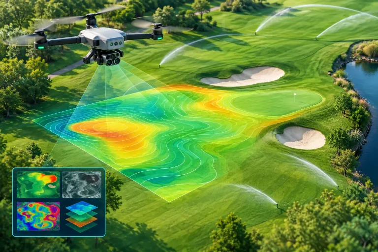
A centimetre-accurate aerial topographical survey and irrigation map creates a dependable base layer for decision-making. It can record sprinkler heads, valve boxes, pipe routes, control points, ponds, tanks, drainage features and elevation changes in one coordinated visual record. Used within irrigation control or course-management workflows, this makes it easier to identify patterns rather than treating each problem area in isolation.
Topography matters particularly on undulating fairways, surrounds and links-style land. Water moves downhill, collects in low points and behaves differently across exposed ridges. A detailed elevation model helps teams understand where run-off is likely, where irrigation may be excessive and which areas need a different approach to scheduling.
How to improve irrigation efficiency with better data
The strongest irrigation decisions combine system information with measurements from the turf and soil. Controller runtimes alone cannot show whether water is reaching the intended rootzone, whether one side of a green is drying faster, or whether stress is driven by moisture deficit rather than disease, shade or compaction.
Measure moisture, not just rainfall
Rainfall totals from a weather station are useful, but they are not a substitute for soil-moisture readings taken across the course. A short, intense shower may wet the surface without replenishing the rootzone. Equally, a sheltered area may retain moisture long after an exposed green has dried.
Use a consistent sampling routine across representative locations, with additional checks on known dry spots, high-wear approaches and sandy profiles. The objective is to establish acceptable moisture ranges for each surface, not to chase one universal figure. Greens, tees, fairways and newly renovated areas have different agronomic requirements and risk profiles.
Where budgets allow, fixed sensors can add continuous readings. Hand-held probes remain valuable because they allow a greenkeeper to investigate conditions at the precise point where turf performance changes. Neither tool replaces observation. Firmness, rooting depth, infiltration, shade and wind exposure should all inform the final watering decision.
Use aerial analysis to find uneven performance
Multispectral aerial surveys can reveal variations in plant vigour across large areas that may be difficult to identify from ground level. Patterns of weaker turf can indicate inconsistent irrigation coverage, blocked nozzles, leaks, drainage limitations or differences in soil structure. The value is in comparing those patterns with irrigation zones, elevation data and on-the-ground moisture readings.
This is not a case of assuming every low-vigour area needs more water. Applying additional water to a stressed area caused by poor drainage or compaction can worsen the problem. Aerial imagery should direct inspection and investigation, allowing the team to confirm the cause before changing programmes or committing to remedial work.
Test distribution before changing runtimes
Increasing runtimes is a common response to dry turf, yet it can mask uneven distribution and raise water, energy and labour costs. A sprinkler system may deliver the correct total volume while still producing wet and dry areas because heads are misaligned, pressure varies or nozzles are worn.
Carry out regular catch-can tests on greens, tees and other high-value surfaces. These tests show how evenly water is being distributed and identify whether individual heads are underperforming. Check arc settings, rotation, nozzle condition, pressure and spacing as part of the same exercise. A head that has settled, been damaged by maintenance equipment or become partially obstructed can affect a surprisingly large area.
Pressure testing is equally important. Low pressure can reduce throw and create dry margins, while excessive pressure can produce misting and wind drift. The best pressure is not necessarily the highest available pressure – it is the pressure specified for the nozzle and sprinkler arrangement in use.
Schedule around demand and conditions
Watering to a fixed calendar is rarely efficient. Irrigation demand changes with temperature, wind, humidity, solar radiation, rainfall, rooting depth and the type of surface being managed. A programme that worked during a mild week can become excessive or insufficient within days.
Weather-based scheduling provides a stronger starting point, especially when adjusted with local moisture readings and field observations. In many situations, deeper and less frequent watering is preferable to frequent light applications because it encourages deeper rooting. However, that principle depends on soil type, slope, drainage capacity and the risk of run-off. Heavy soils may need slower cycle-and-soak applications, while sandy rootzones may require more carefully timed pulses to retain moisture in the target zone.
Run irrigation during lower-evaporation periods where practical, while accounting for disease pressure, overnight leaf wetness and operational constraints. On exposed sites, avoid programming long cycles during periods of strong wind, when distribution is less predictable. The right timing will vary across the course, so separate control zones are essential where infrastructure permits.
Fix losses before investing in more capacity
Water loss is not always visible. Leaks in mainlines or laterals may emerge as persistently soft ground, unexplained controller run-time changes, pressure loss or a sudden increase in water use. Valve faults can also lead to irrigation continuing after the intended cycle has finished.
Maintain a clear inspection and maintenance record for pumps, filters, valves, heads, nozzles and control equipment. Compare flow data against expected demand by zone. A material change should trigger investigation, not simply a larger water allocation. Mapping underground infrastructure makes this work faster and reduces the risk of unnecessary excavation when locating faults.
Do not overlook filtration and water quality. Sediment can block nozzles and affect uniformity, while water chemistry can influence soil structure and infiltration over time. Where water is abstracted from a pond or borehole, seasonal changes in supply quality may deserve closer monitoring.
Match investment to the real constraint
A new central controller, additional moisture sensors or a major irrigation replacement can all deliver value, but only when they address the actual source of inefficiency. Some courses will gain more from accurate asset mapping, head maintenance and improved scheduling than from a wholesale technology upgrade. Others may have ageing infrastructure that prevents precise control regardless of how good the data is.
Prioritise work according to playing-surface risk, water cost, labour demand and the scale of the performance issue. Start with areas where poor coverage or excess application is affecting greens, key approaches, tees or highly visible fairways. Establish a baseline for water use, moisture levels and turf quality, then measure the result of each intervention.
For renovation projects or long-term irrigation planning, survey-grade aerial mapping provides a practical foundation for designers, irrigation specialists and contractors to work from the same accurate information. Vantage Imagery Limited supports this process with precision aerial data that turns complex course infrastructure into a usable planning asset.
The most efficient golf-course irrigation systems are not those that run the least. They are the systems that give the greenkeeping team confidence to act precisely, protect the turf under pressure and avoid spending water where it delivers no playing or agronomic benefit.
