
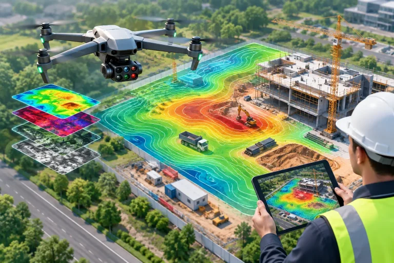
A programme can look healthy in a weekly meeting, then reveal a different story when viewed across the whole site. Stockpiles have shifted, access routes are blocked, earthworks are behind sequence, or water is collecting where it should not. Knowing how to monitor construction sites properly means creating an accurate, repeatable record of what is happening on the ground – not simply collecting occasional aerial photographs.
For construction managers, developers and contractors, the right monitoring approach turns site activity into evidence. It gives project teams a clearer basis for planning works, communicating with stakeholders and responding before small deviations become costly delays.
Start with the decisions the monitoring must support
Construction monitoring is most valuable when it answers specific operational questions. Before arranging a survey, establish what the project team needs to see and how often it needs to see it. A monthly record may be sufficient for a long-term development at an early earthworks stage, while weekly or fortnightly capture can be more appropriate during rapid structural progress, complex groundworks or constrained access periods.
The objectives will vary by project. You may need to verify progress against a programme, measure cut and fill volumes, record drainage installation before it is covered, track material storage, assess vehicle movements or provide visual evidence for clients and funders. These requirements determine the flight plan, survey accuracy, reporting format and capture schedule.
This early definition matters because a visually impressive image is not necessarily useful project data. If quantities, levels or dimensions will inform decisions, imagery should be captured and processed as a survey-grade dataset rather than treated as promotional content.
Build a repeatable site-monitoring baseline
The first survey should establish a reliable baseline. This normally includes a current orthomosaic – a geometrically corrected aerial image that can be measured accurately – alongside a digital surface model, annotated site plan or topographical mapping where required.
A baseline allows later captures to be compared like for like. Without it, teams often rely on memory, phone images and changing viewpoints. That can make it difficult to demonstrate exactly when an issue emerged or whether an area has progressed as expected.
For precision work, ground control points or RTK-enabled drone workflows help achieve centimetre-level positioning. The most suitable method depends on site size, access, required tolerances and whether the data will be used for measurement, design coordination or general progress reporting. A competent survey provider should explain the achievable accuracy and any limitations clearly.
Use consistent capture methods for meaningful comparisons
Consistency is what turns drone surveys into construction monitoring rather than a collection of aerial updates. Flights should follow the same planned route, altitude, camera settings and site coverage wherever practical. Matching the capture geometry makes change easier to identify and reduces ambiguity between reporting periods.
Weather and site conditions still matter. Low winter light, standing water, dust, wind and active plant can affect image quality and interpretation. These factors do not make monitoring impossible, but they should be recorded so that project teams understand the context behind each dataset.
Repeatable capture is particularly useful for:
- earthworks and stockpile volume tracking
- structural progress and sequencing reviews
- drainage, utilities and service trench records
- access, compound and logistics planning
- photographic evidence for stakeholder updates
The key is to capture at a frequency that reflects the pace and risk of the work. Monitoring too rarely can leave teams reacting late. Capturing too often without a defined purpose can generate files without improving control of the project.
Combine visual progress with measurable survey data
Aerial imagery gives an immediate overview that is difficult to obtain from ground level, especially on large, fragmented or hazardous sites. However, the strongest monitoring programmes combine visual clarity with data that can be interrogated.
Orthomosaic maps allow teams to view the entire site at high resolution, add annotations and identify changes in layout. Digital terrain and surface models can support level comparisons, drainage assessments and earthworks analysis. Point clouds provide a detailed three-dimensional representation that can be compared with design information or previous surveys.
For earthworks, cut-and-fill calculations and stockpile volumes can support more confident decisions around material movement, disposal and import requirements. Accuracy expectations must be realistic: volume calculations are only as reliable as the survey method, ground visibility and defined comparison surfaces. Vegetation, machinery and loose material can all influence results.
Where construction affects an existing golf course, estate or managed landscape, mapped data can also help protect operational assets. Drainage runs, irrigation infrastructure, pathways, mature trees and playing surfaces can be recorded before works begin, then monitored throughout the project. This provides useful evidence where access, reinstatement or contractor coordination need close control.
Make reporting easy for the whole project team to use
Monitoring data only delivers value if it reaches the people making decisions. The best reporting is clear enough for a client or commercial manager to understand quickly, while retaining the technical detail required by surveyors, engineers and site teams.
A practical report might include a dated site overview, consistent comparison imagery, annotated observations, progress photographs from agreed viewpoints and relevant measurements. For a larger project, outputs can be issued in formats that work alongside CAD drawings, GIS platforms or project management workflows.
Annotations should be factual and specific. Rather than stating that an area is “behind”, identify what is visible: for example, the access road formation remains incomplete, the attenuation basin excavation has not reached the planned extent, or materials are stored within a designated working area. This creates a more useful record and avoids turning survey imagery into unsupported commentary.
Keep safety, permissions and site coordination central
Drone monitoring can reduce the need for people to enter difficult or exposed areas, but it does not remove the need for proper site control. Flights must be planned around lifting operations, plant movements, exclusion zones, adjacent properties and people on site.
In the UK, commercial drone operations must be conducted within the applicable Civil Aviation Authority requirements. A professional operator will assess airspace, site hazards, take-off and landing areas, weather conditions and any permissions needed before flying. They should also coordinate with the principal contractor or site manager so that the survey supports, rather than disrupts, site activity.
A drone survey is not a substitute for statutory inspections, engineering sign-off or hands-on safety checks. It is a powerful additional source of visibility. Used correctly, it can direct attention to areas that need ground-level investigation while maintaining a permanent visual record of conditions.
Set a monitoring cadence that changes with the project
A fixed schedule is useful, but it should not become inflexible. Early enabling works may need a baseline and occasional volume surveys. During bulk earthworks, frequent monitoring can support quantities and programme control. Once the build becomes more vertical, regular imagery may be most useful for tracking trade sequencing, delivery logistics and stakeholder reporting.
Trigger-based surveys are equally valuable. Consider commissioning a capture before and after major phases such as demolition, piling, drainage installation, concrete pours, road construction or landscaping. These records can preserve evidence of work that will no longer be visible once the next activity begins.
For projects with changing requirements, a consultative provider can adapt outputs as the work develops. Vantage Imagery Limited, for example, combines repeatable drone capture with precision mapping to provide construction teams with data they can use beyond a standard progress photograph.
Treat monitoring as project intelligence, not a presentation exercise
The aim is not to produce attractive aerial content for its own sake. It is to give decision-makers a dependable view of what has changed, what needs attention and what can be verified. When survey-grade capture, consistent reporting and site knowledge work together, construction monitoring becomes a practical control tool that keeps the project visible long after the flight has ended.
The most useful next step is to identify one upcoming milestone where better evidence would change a decision – then design the monitoring around that moment.