 Skip to main content
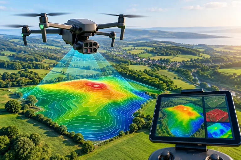
A golf course can look immaculate from ground level while concealing drainage issues, stressed turf, uneven surfaces and poorly documented underground infrastructure. That is why the best drone surveys UK providers are not simply those with impressive aircraft or attractive aerial photographs. They are the teams that turn high-quality capture into accurate, usable information for decisions on the course, on site and in the boardroom.
For golf clubs, estates and land managers, the difference matters. A vague aerial image may be useful for marketing. A centimetre-accurate survey, correctly processed and delivered in the right format, can support irrigation planning, drainage investigations, redesign work, maintenance programmes and capital investment.
What separates a drone survey from aerial imagery?
Drone imagery is the raw visual record captured from the air. A drone survey is a measured dataset. It involves planned flight paths, appropriate ground control or real-time correction technology, rigorous processing and quality assurance. The output may include an orthomosaic, topographical model, contour plan, point cloud, digital terrain model or a measured overlay of course assets.
This distinction is particularly important on golf courses. Fairways, greens, bunkers, water features, paths, woodland and buildings create a complex environment. If survey data is to inform irrigation adjustments or drainage design, it must represent the site reliably rather than merely look convincing on screen.
A professional operator should be able to explain the expected positional accuracy, the method used to achieve it and any limitations caused by tree cover, standing water, restricted access or surface conditions. Centimetre-level results are achievable in suitable conditions, but they are not automatic simply because a drone has a high-resolution camera.
Choosing the best drone surveys UK service for your site
The right provider depends on what you need to manage. A construction manager tracking earthworks has different priorities from a course manager assessing turf stress. Yet the strongest drone survey services begin with the same question: what decision will this data support?
If the objective is to map a golf course for operational planning, the provider should understand the assets that matter. That includes greens, tees, bunkers, fairways, paths, drainage runs, irrigation heads, valve boxes, ponds, outfalls and maintenance areas. A generic aerial mapping company may produce a broad site plan, but a golf-sector specialist is more likely to structure data around the way a club actually operates.
Start with the required deliverables
Before comparing quotations, establish what you need to receive at the end of the project. An orthomosaic is valuable for a clear, scaled overhead view of the site. A digital terrain model and contours reveal levels, slopes and water movement. A point cloud can support detailed design and modelling. Multispectral imagery can identify variation in plant health that is difficult to see consistently from the ground.
For some projects, a PDF plan is sufficient. For others, survey files must work within CAD, GIS, irrigation control or course-management systems. The latter requires more than a polished image. It requires compatible formats, clear layers, sensible naming and data that can be handed to an architect, agronomist, engineer or contractor without creating extra work.
Ask providers to state exactly what will be supplied, at what resolution, in which coordinate system and with what stated accuracy. This removes ambiguity early and makes proposals easier to compare.
Look beyond headline accuracy
Claims of centimetre accuracy should be backed by a credible workflow. Depending on the site and deliverable, this may include RTK or PPK positioning, surveyed ground control points and independent check points. These methods help tie aerial data to real-world coordinates and verify the finished model.
Accuracy also has a vertical dimension. Horizontal position may be excellent while elevation data is less reliable under dense tree canopy or in areas obscured from view. On a golf course, this is relevant around mature woodland, steep banks, bridges and enclosed drainage features. A capable survey partner will be clear about where drone capture performs best and where terrestrial survey, utility records or targeted site checks are needed.
That candour is a positive sign. No one survey method is perfect for every part of every site. The best approach combines technologies where necessary to produce data that is fit for purpose.
Assess sector experience, not just flying experience
Legal and safe flight operations are essential. Commercial clients should expect an operator to hold the appropriate permissions, insurance and operational procedures for the work being carried out. However, compliance alone does not make a provider a survey specialist.
Relevant experience changes the quality of the brief, capture plan and interpretation. A team familiar with golf course operations understands that a survey must avoid disrupting play where possible, account for changing light and seasonal turf conditions, and capture assets in a form that maintenance teams can use. They will also recognise that a suspected drainage issue is not solved by imagery alone – it needs levels, flow context and practical discussion with those who know the course.
The same principle applies to construction and property work. For roof inspections, image clarity and safe standoff distances may be the priority. For stockpile volumes, repeatable levels and comparison periods are central. For promotional video, visual storytelling takes precedence over survey-grade outputs. Be wary of a supplier presenting one type of capture as the answer to all three.
Where drone data creates operational value
A well-planned aerial survey can reduce the time spent walking large sites, improve communication between stakeholders and create a shared visual reference for future works. Its real value lies in how it improves the next decision.
For golf clubs, accurate base mapping can support an irrigation upgrade by locating visible assets and presenting the course in a clear, scaled format. It can help consultants assess surface-water routes, identify low points and plan investigations. When combined with existing utility records and on-site verification, it creates a more practical starting point for drainage or infrastructure work.
Multispectral plant-health analysis has a different role. It can reveal patterns of stress across greens, tees or fairways, helping teams prioritise inspections and investigate whether irrigation performance, compaction, disease pressure, shade or nutrient variation may be involved. It does not replace the judgement of a greenkeeper or agronomist. It directs attention to areas where that judgement is most needed.
Repeat surveys are equally useful when conditions need to be tracked rather than captured once. Construction sites can be monitored for progress, quantities and change. Golf courses can document renovation works, bunker projects or drainage installations at key stages. Consistent flight planning and processing make those comparisons more meaningful.
Questions worth asking before you appoint a provider
A useful proposal should answer the practical questions, not just describe the drone. Ask how the survey will be planned around site access and operations, what accuracy can realistically be achieved, and how it will be checked. Ask whether the supplier has delivered similar work for golf, land management, construction or property clients with comparable requirements.
It is also worth asking who will process the data and who will explain it afterwards. Survey outputs can be technically correct yet difficult to apply if they arrive without context. The strongest providers remain available to discuss layers, measurements, findings and file use with the people responsible for acting on them.
Price should be considered in that context. The lowest quotation may cover a short flight and a folder of images, while a more complete scope includes control, processing, measured outputs, asset overlays and consultation. Neither is automatically right or wrong. The critical point is to compare like with like and pay for the level of confidence your project requires.
Make the survey part of the plan
The most valuable aerial data is commissioned before a problem becomes expensive. Mapping a course before an irrigation renewal, capturing levels before drainage works, or recording a construction site before major changes provides a dependable baseline. It also gives every consultant, contractor and decision-maker a clearer view of the same ground.
For a golf club, that can mean fewer assumptions when planning investment and more confidence that works are directed where they will have the greatest effect. Choose a drone survey partner that treats accuracy, deliverables and practical use as one service – then put the information to work while it can still shape the outcome.
