 Skip to main content
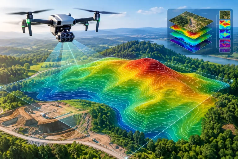
A new drainage issue on the 14th fairway, an irrigation extension or a planned clubhouse development can all appear straightforward until levels, falls and buried assets are brought into the conversation. An aerial topographic survey turns a complex site into measured, usable data, giving decision-makers a reliable picture of what is happening across the ground before money is committed or work begins.
For golf courses, estates and construction sites, the value is not simply a striking aerial image. It is the ability to measure terrain accurately, understand water movement, identify constraints and share a common reference plan with contractors, consultants and operational teams.
What an aerial topographic survey delivers
An aerial topographic survey uses a drone, survey control and specialist processing software to capture detailed imagery and elevation information across a site. The resulting data can be processed into a georeferenced orthomosaic, contour plan, digital terrain model, surface model and point cloud. Each output has a different operational purpose, but together they create an accurate digital representation of the site.
The distinction matters. A conventional aerial photograph may show a low area on a fairway, but it cannot confirm whether the ground falls by 100 mm or 1 metre, nor show how that low point relates to nearby drains, bunkers, paths or irrigation infrastructure. Survey-grade aerial data is designed to answer those practical questions.
With suitable ground control, flight planning and processing, drone surveys can achieve centimetre-level positional accuracy. The required tolerance will vary by project. Early-stage feasibility work may need clear contours and a dependable overview, while drainage design, earthworks calculations or detailed course remodelling may require tighter control and more detailed deliverables.
Why terrain data changes golf course decisions
Golf courses are large, varied landscapes where subtle changes in level have a direct effect on playability, maintenance effort and capital planning. Water does not respect hole boundaries, and an apparent problem on one fairway can begin much further uphill.
A detailed terrain model allows course managers, architects and irrigation specialists to see falls across greens, approaches, fairways, rough, paths and surrounding land. This supports better conversations about where water is collecting, where surface flow is likely to travel and whether existing drainage arrangements make sense in the wider landscape.
For irrigation planning, accurate mapping provides a dependable base layer for heads, valves, pipe routes and control zones. Rather than relying on incomplete historic drawings or memory, teams can overlay known assets onto current aerial mapping. This makes it easier to plan repairs, extensions and phased upgrades while reducing the risk of unnecessary excavation.
The same survey can support bunker renovation, tee construction, path design and course remodelling. Calculated cut-and-fill volumes help project teams compare design options before machinery arrives. A small change in level can significantly affect material movement, costs and programme duration, particularly where access is constrained or soils need to be retained on site.
The difference between imagery and survey data
Drone imagery is valuable, but image quality alone does not make it a topographic survey. Accuracy is influenced by equipment, flight height, camera calibration, overlap, terrain conditions, GNSS capability, ground control and the way data is processed and checked.
Survey control is particularly important. Ground control points are measured targets placed across the site, allowing drone imagery to be tied to a known coordinate system. They provide an independent framework for the mapping output and help validate its accuracy. On larger or more demanding sites, the distribution and quality of this control can make a meaningful difference to the final result.
There is also a distinction between a digital surface model and a digital terrain model. A surface model represents everything visible from above, including trees, buildings, vehicles and dense vegetation. A terrain model aims to represent the bare ground beneath those features. Where woodland, long rough or heavy canopy is present, photogrammetry has limitations because the camera cannot reliably see through obstructions.
This is where project scoping matters. A drone-led approach is highly effective for open ground and visible surfaces, but it may need to be supplemented by ground survey methods in heavily vegetated areas, beneath dense tree cover or where hidden detail is critical. The right solution is not always the one that relies on a single technology.
Planning an aerial topographic survey properly
The best survey outputs start with a clear operational question. Is the objective to investigate recurring wet areas? Build an accurate base plan for an architect? Estimate earthworks? Map irrigation and drainage assets? Monitor construction progress? Each aim affects the survey extent, control requirements, resolution and deliverables.
For a golf course, it is usually sensible to define whether the survey includes only playing areas or the wider catchment that influences drainage. The latter can be crucial. Water entering the course from adjacent land, roads or ditches may be the real cause of a persistent issue, and surveying too narrow an area can create a misleading picture.
Timing also affects results. Mown turf and clear ground conditions generally support cleaner data capture than long grass, leaf cover or standing water. Flights should be planned around weather, wind, light and site activity. A dry visual surface does not necessarily mean a drainage issue has disappeared, so experienced interpretation should combine survey data with local knowledge, maintenance records and observations after rainfall.
Clients should also establish the coordinate system and level datum required at the outset. This helps ensure that new data can align with existing drawings, engineering designs and asset records. It is a small detail with significant consequences: data that looks accurate but does not align with other project information can cause avoidable delays.
From point cloud to practical action
Raw survey data is rarely the final answer. The value comes from presenting it in formats that people can use in their daily work and professional consultations. A greenkeeper may need a clear contour plan and visual overlay; a drainage designer may need spot levels, breaklines and a terrain model; a contractor may need earthworks quantities and set-out information.
A well-prepared orthomosaic provides a current, scaled image of the entire site. It can reveal worn access routes, exposed drainage lines, tree encroachment, surface damage and changing construction conditions. Contours and colour-shaded elevation models make gradients more legible, helping non-survey specialists identify high and low ground quickly.
For larger projects, point clouds and CAD-compatible files can support detailed design workflows. These technical datasets should be accompanied by a clear explanation of their coordinate reference, accuracy, date of capture and known limitations. Precision is useful only when the people using the data understand what it represents.
Vantage Imagery Limited focuses on producing aerial data that can move beyond a presentation drawing and into practical golf course management, irrigation planning and project delivery. That means matching outputs to the decisions a client needs to make, rather than delivering generic imagery with no operational context.
Applications beyond the golf course
The same principles apply across construction, property and estate management. Construction teams can use repeat aerial surveys to document progress, compare existing conditions with design intent and calculate stockpile or earthworks volumes. A current topographic model gives project managers a stronger starting point than outdated plans or fragmented site records.
For estates and facilities teams, accurate aerial mapping can support drainage investigations, access planning, boundary reviews and maintenance prioritisation. Roof inspections are a separate application, but they benefit from the same disciplined approach to flight planning, safe capture and interpretable reporting.
The trade-off is straightforward: not every site needs a high-density point cloud, highly detailed contours or repeated monitoring. Specifying more data than a project can use adds cost without improving the decision. Conversely, cutting survey scope too far can leave critical gaps in the terrain or asset picture. A consultative survey approach identifies the level of detail that will genuinely support the next stage of work.
Choosing a survey partner
A professional aerial survey should be judged on more than the drone being used. Ask how accuracy will be established and checked, what outputs will be supplied, whether the data will align with existing site information and how limitations will be managed. For golf projects, sector knowledge is equally valuable because survey findings need to be interpreted in the context of play, turf health, machinery access, irrigation and drainage.
Certified operations, appropriate insurance, safe working procedures and responsive communication are not extras. They are part of delivering dependable data with minimal disruption to a live course, construction site or commercial property.
The strongest starting point is a defined question: what decision needs to be made, and what evidence will give that decision confidence? Once that is clear, an aerial topographic survey becomes far more than a map. It becomes a precise working foundation for better land management.
