 Skip to main content
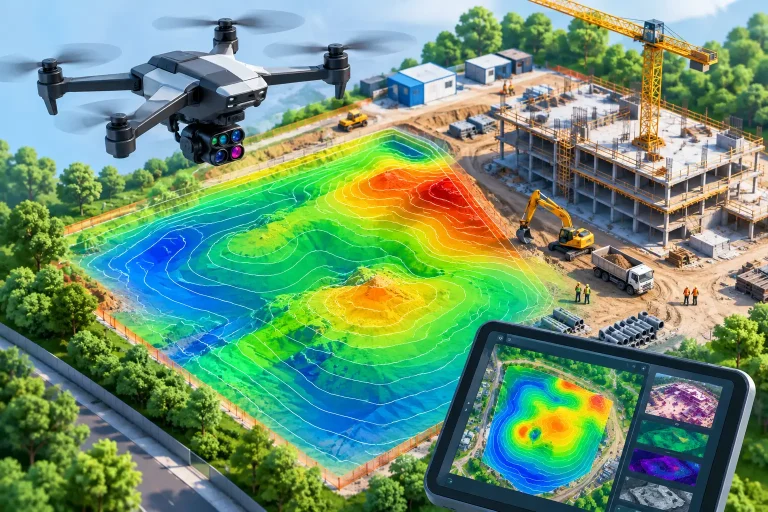
A construction programme can lose days before a delay is visible from the site office. Material storage drifts into access routes, earthworks move beyond the latest drawing, or a subcontractor completes work that is then covered before it has been recorded. A structured construction site monitoring guide gives project teams a current, measurable record of what is happening on site, not simply a collection of aerial photographs.
For contractors, developers and project managers, the objective is practical control. Monitoring should make progress easier to verify, enable clearer reporting, support safer planning and provide reliable evidence when questions arise. Drone capture is particularly valuable because it can cover large, changing sites quickly while producing imagery and mapping products that people can use in their established workflows.
Start with the decisions the data must support
The most effective monitoring programme begins before the first flight. Ask which decisions are currently slowed by incomplete site visibility. On one project, the priority may be measuring cut and fill volumes. On another, it may be proving weekly progress to a funder, coordinating roof works, or identifying where temporary works and welfare facilities are affecting logistics.
This matters because a high-resolution orthomosaic, a progress video and a survey-grade topographical model are different outputs. They can be captured during related visits, but they require different levels of ground control, processing and quality assurance. Treating every drone flight as a general photography exercise can create attractive imagery without delivering the information the project team actually needs.
Agree the required accuracy, reporting frequency, site boundary, key work fronts and stakeholders at the outset. Establish who will review the outputs and what action they are expected to take. A weekly visual update may be appropriate during structural works; daily capture may be justified for a complex logistics operation; and monthly mapping can be sufficient during slower phases. The right frequency depends on the programme risk and the rate at which the site changes.
Construction site monitoring guide: build a reliable baseline
A baseline survey is the reference point for the entire project. It records existing levels, features, boundaries, access constraints and neighbouring interfaces before ground is broken or early works alter the terrain. Without it, later discussions about quantities, drainage routes or pre-existing conditions can become unnecessarily difficult.
For measurement-led work, the baseline should use appropriate ground control and a defined coordinate system. Centimetre-accurate aerial mapping is not achieved by flying a drone alone. It depends on a suitable flight plan, reliable positioning, control points, image overlap, processing discipline and checks against known points on the ground.
A properly produced orthomosaic gives the team a scaled, distortion-corrected aerial plan. It is useful for marking compound locations, reviewing haul routes and comparing installed works against design information. A digital surface model can show the height of the terrain and objects above it, while a bare-earth terrain model may be needed where vegetation or temporary features need to be filtered out. The distinction matters when calculating volumes or setting out drainage and formation levels.
Capture progress consistently, not occasionally
Consistency is what turns site imagery into a monitoring record. Capture from the same viewpoints, flight heights and general directions on each visit where practical. Repeatable coverage allows teams to compare like with like and see whether work is progressing in the areas that matter.
The monitoring plan should include both wide-area mapping and targeted detail. Wide-area coverage shows the relationship between work packages, access, storage and surrounding constraints. Targeted imagery records specific assets such as retaining walls, roof structures, drainage runs, cladding, plant areas or difficult-to-reach elevations.
Weather, lighting and site activity introduce trade-offs. Low sun can improve visual definition but create long shadows that obscure details. Wind, rain and restricted access can prevent a planned flight. Active lifting operations, cranes and plant movements require careful coordination. A professional operator will work within the site safety arrangements and adjust the capture plan where conditions make safe or useful data collection impossible.
It is also worth agreeing naming conventions and dates for each deliverable. A clearly labelled set of outputs, matched to a report date and site phase, is far more useful than folders of unstructured images received weeks later.
Use visuals and measurements together
Progress photographs answer questions such as, “Has the slab been poured?” Mapping answers, “Where does the completed slab sit, what area does it cover and how does it relate to the approved layout?” Both are valuable, but neither should be presented as a substitute for the other.
Where earthworks are involved, regular surface models support stockpile measurement and cut-and-fill comparisons. Quantities should be calculated against an agreed reference surface, such as the baseline terrain, design formation or a previous survey. The figures are only meaningful when that comparison method is stated clearly.
For linear services and drainage, aerial data can help record open trenches and installed routes before reinstatement. This is particularly useful on sites where later maintenance teams will need evidence of what lies beneath finished surfaces. It should complement, not replace, statutory records, as-built requirements or utility detection procedures.
Make monitoring part of site management
Monitoring delivers the strongest return when it appears in the regular management rhythm of the project. Site teams can review current aerial maps during coordination meetings, compare progress against the short-term programme and flag issues that need a ground-level inspection.
A monthly report for clients or funders may combine selected overview images, annotated milestones, a plan of the current site layout and volume information where relevant. This makes progress easier to understand for people who are not on site every day. It also reduces the risk that reporting relies on isolated photographs that lack context.
For contractors, the same information can improve logistics planning. Seeing the whole site from above can reveal pinch points around delivery routes, material laydown areas and turning spaces that are difficult to recognise at ground level. It can also help teams plan the movement of plant as work fronts shift.
Do not overstate what aerial monitoring can do. A drone image cannot confirm workmanship hidden behind finishes, replace a competent inspection, or determine whether a structure complies with every specification. It provides an accurate visual and spatial record that helps direct attention. The appropriate engineer, surveyor or quality professional must still make technical judgements within their remit.
Set clear standards for safety, privacy and data control
Construction sites are demanding operating environments. Monitoring flights must be planned around people, vehicles, cranes, exclusion zones, nearby property and airspace requirements. The operator should hold the relevant permissions and insurance, complete site-specific risk assessments and coordinate directly with the principal contractor or designated site contact.
Privacy and commercial sensitivity also require attention. Imagery may capture neighbouring land, vehicle registrations, workers or confidential construction details. Define how imagery will be stored, who can access it and how long it will be retained. If the outputs are intended for public-facing communications, separate that brief from the technical monitoring record and obtain the necessary approvals.
For survey outputs, request a concise methodology statement. It should identify the coordinate reference, control approach, capture date, deliverable format and any limitations caused by obstructions, shadows, vegetation or site access. This gives design teams confidence about whether the data is suitable for CAD, BIM coordination, quantity analysis or visual reporting.
Choose outputs people can act on
The best deliverable is not always the most complex one. A project manager may need a dated, annotated aerial plan that can be discussed in ten minutes. A commercial team may need measured volumes with a stated basis of calculation. A design consultant may need georeferenced imagery or point-cloud data that can be compared with design models.
Before appointing a monitoring provider, confirm that they can supply the relevant formats and explain the accuracy that can realistically be achieved. Ask how ground control will be established, how data will be checked and what happens when poor weather or site restrictions affect a scheduled visit. Responsiveness matters, but dependable methodology matters more.
Vantage Imagery Limited approaches construction tracking as a precision data service, combining repeatable drone capture with mapping outputs designed for clear operational decisions. The value is not the flight itself. It is the confidence to plan, report and resolve issues from a current view of the site.
A well-run monitoring programme creates a practical history of the build: a baseline before change, consistent evidence during delivery and accurate records for handover. Start with the decision that needs improving, then specify the imagery, mapping and measurement required to support it.
