 Skip to main content
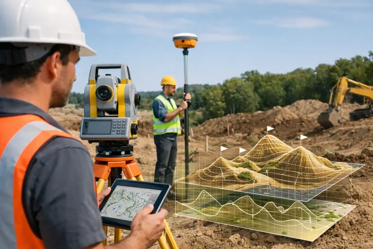
A proposed drainage run that looks straightforward on an aerial image can fail on the ground if levels fall the wrong way by only a few centimetres. That is why the question, what does a topographical survey show, matters well beyond the drawing itself. It provides a measured picture of the land, allowing managers, designers and contractors to understand what is there, how it sits, and what may affect the work planned.
For golf courses, estates, construction sites and commercial properties, a topographical survey turns a complex physical site into reliable spatial data. The value is not simply seeing the site from above. It is having accurate information that supports decisions on drainage, irrigation, earthworks, access, maintenance and development before money is committed on the ground.
What does a topographical survey show?
A topographical survey records the position, height and shape of natural and built features across a defined area. Its central purpose is to show horizontal location and vertical elevation together. In practical terms, it answers three essential questions: where is a feature, what is it, and how high or low is it relative to the rest of the site?
The final output is usually a detailed plan, digital model or CAD-ready dataset. It may be presented as a colour map for straightforward review, but the underlying data is what gives it operational value. Surveyed coordinates and levels can be used by architects, engineers, irrigation designers, golf course architects and contractors without relying on assumptions made from photographs or outdated plans.
Ground levels, spot heights and contours
Levels are the foundation of a topographical survey. A survey may show spot heights at specific points, contours that join locations of equal elevation, or both. Together, they reveal gradients, ridges, hollows, embankments and low points where water is likely to collect.
Contours are particularly useful when assessing the wider shape of land. Closely spaced contours indicate a steeper slope, while wider spacing generally shows gentler ground. Spot heights add precision at key locations, such as proposed drainage outfalls, tee surrounds, pathways, building thresholds or inspection chambers.
On a golf course, these levels help establish whether surface water has a viable route away from greens, bunkers and fairways. They also inform cut-and-fill calculations for remodelling work and provide a defensible base plan for new irrigation design.
Natural and built site features
A topographical survey identifies the visible features that could influence design, operations or access. The exact scope should be agreed before work begins, but it commonly includes:
- buildings, walls, fences, gates and hardstanding;
- roads, paths, kerbs, tracks and car parks;
- trees, woodland edges, hedges, watercourses and ponds;
- bunkers, greens, tees, ditches and other golf course features;
- drains, gullies, manholes, chambers, poles and visible service markers.
Each feature is positioned accurately and classified so that it can be understood in context. A pond is not simply an area of blue on an image. Its edge, surrounding levels, inlets, outlets and relationship to nearby ground can all be relevant to drainage planning, habitat management or course presentation.
Boundaries and visible extents
Survey plans can show fences, hedgerows, walls and other physical boundary features. This is valuable for planning work areas, measuring land parcels and understanding interfaces with neighbouring land.
There is an important distinction, however. A topographical survey shows visible boundary features, not necessarily the legal title boundary. Where ownership, rights of way or a boundary dispute is involved, legal records and specialist land advice are required. Treating a fence line as definitive legal evidence can create expensive problems.
Drainage and surface-water indicators
Topographical data does not prove the condition or route of an underground drainage system, but it provides critical evidence for understanding how water behaves on the surface. It can show ditches, swales, gullies, watercourses, ponds, headwalls and visible manholes, alongside the gradients that influence runoff.
This matters where a course has persistently wet areas, a construction site needs a temporary drainage strategy, or an estate is considering new hard surfaces. When combined with utility information, drainage investigations and site knowledge, the survey creates a far stronger basis for diagnosing water-management issues than visual inspection alone.
What a topographical survey does not show
A quality survey is precise, but it is not a substitute for every form of site investigation. It will not automatically reveal buried pipes, cables, voids, contaminated ground, soil composition or legal boundaries. Dense vegetation can also obscure the ground and limit what aerial photogrammetry can measure reliably beneath the canopy.
These limitations are not a reason to avoid survey work. They are a reason to define the brief properly. For example, a utility overlay can combine surveyed above-ground features with available statutory utility records, while ground-penetrating or trial-hole investigations may be needed where buried assets are critical. On heavily wooded land, a drone survey may need to be supported by targeted ground control or terrestrial measurements.
The right approach depends on the decision being made. A high-level feasibility study may need broad contours and key features. Detailed construction design needs tighter control, clear coordinate systems and a survey specification agreed with the project team.
How drone topographical surveys produce usable data
Drone surveying can capture a large site quickly, particularly where access is difficult or conventional fieldwork would take longer. A planned flight gathers overlapping imagery, which specialist photogrammetry software uses to reconstruct the site in three dimensions. With survey-grade ground control and suitable processing, this can deliver centimetre-accurate mapping for appropriate applications.
The important phrase is “for appropriate applications”. Accuracy is determined by more than the drone. It depends on the survey control, equipment, flight height, image quality, site conditions, processing method and the checks applied to the finished data. A clear open fairway can be mapped very differently from a woodland margin, a deep ditch or a site with reflective water.
A professional survey workflow therefore includes pre-survey planning, an agreed coordinate reference system, controlled data capture and independent quality checks. The result can include an orthomosaic – a geometrically corrected aerial image – as well as contours, spot levels, point clouds, digital terrain models and CAD layers. Different teams can then use the same surveyed base information in the format that suits their workflow.
Why this matters for golf course management
Golf course decisions are highly dependent on small changes in level. Water does not care whether a slope looks flat from a buggy path. A subtle fall can determine whether a green drains efficiently, whether a bunker floods, or whether an irrigation main can be installed with sensible trench routes and access.
A detailed topographical survey supports better planning across the course. It can establish accurate areas for greens, tees, bunkers and fairways; provide a base map for irrigation upgrades; record drainage features; and give architects dependable information before reshaping holes. It also creates a useful baseline. When a reconstruction, drainage scheme or ecological project is completed, the survey data helps quantify what changed rather than relying on recollection or unscaled imagery.
For club managers and greenkeeping teams, this is about reducing uncertainty. Rather than commissioning work based on approximate drawings, they can assess levels, distances and constraints before specifying a solution. That can reduce rework, avoid clashes with visible assets and make contractor discussions more productive.
Getting the brief right before a survey
The most useful topographical survey begins with the intended outcome. A surveyor needs to know whether the data will support drainage design, a planning application, irrigation mapping, course remodelling, construction progress tracking or general asset management. That determines the survey extent, level of detail, accuracy requirement and outputs.
Ask for the coordinate system and datum to be stated clearly, especially if the survey will be used alongside existing drawings or design files. Confirm which features must be captured and whether vegetation, water levels, site access restrictions or active operations could affect the work. If underground services are a concern, establish from the outset how those records will be obtained and presented.
Vantage Imagery Limited applies this precision-led approach to drone mapping, producing practical survey outputs that can be used in golf course and land-management decisions rather than left as attractive aerial imagery.
The best time to commission a topographical survey is before the site becomes a problem. Accurate levels and clearly mapped features give every later conversation – from drainage design to contractor pricing – a firmer place to start.
